One third of Tanzania's total area is under protection. For an overview of the many national parks and protected areas, we outline them in three regions:
South & Central Tanzania: The southern national parks captivate visitors with their biodiversity and varied, untouched landscapes. They are unjustly less known than the famous parks up north. But then, this fact allows you to enjoy exciting trips away from mass tourism.
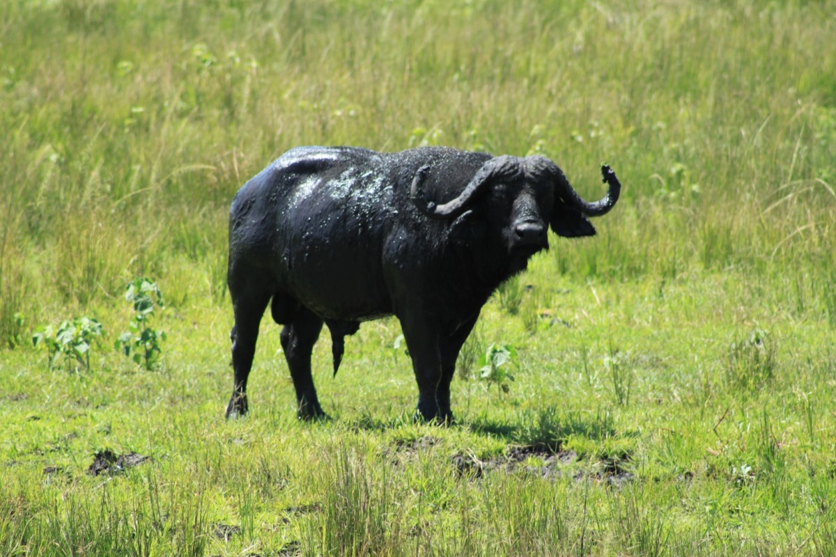
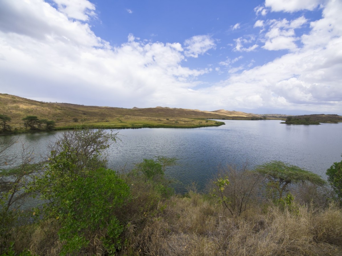
West: A trip to the west of Tanzania may be time-consuming, but it's always worthwhile: You will get to watch chimpanzee families and bathe in the world's second largest freshwater lake at Mahale National Park on Lake Tanganyika. You will come across herds of buffalo in the wilderness of Katavi National Park and witness the vibrant red orchid fields of Kitulo National Park.
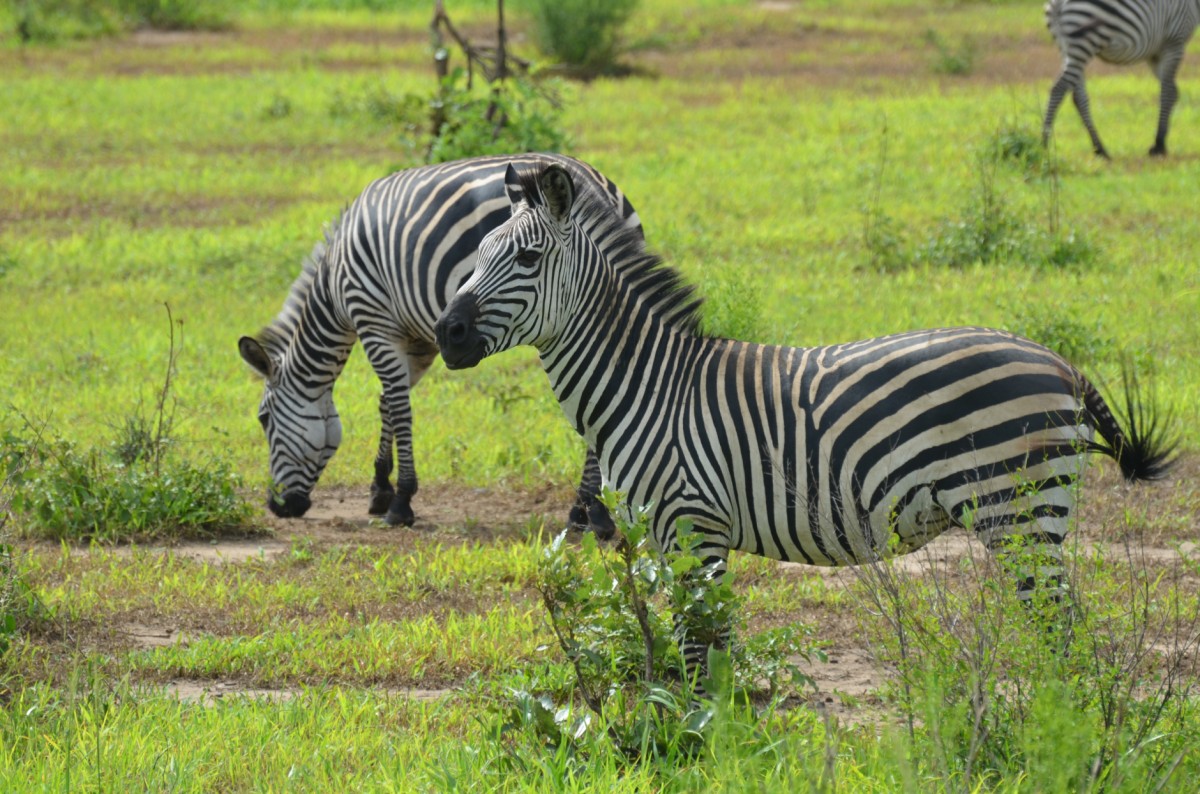
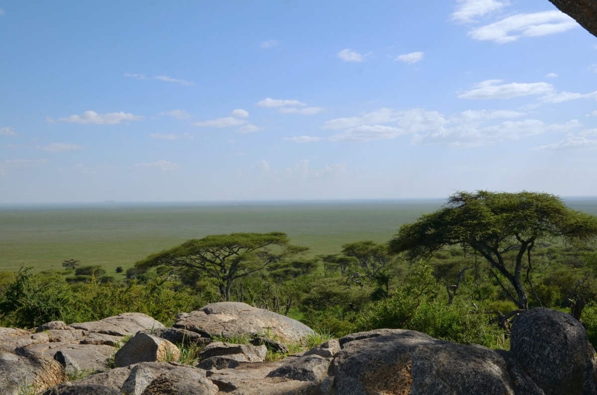
North: The world famous Serengeti, Ngorongoro Crater, or Kilimanjaro are all famous and popular. Some of them have been included in the list of UNESCO World Heritage Sites. But in addition to all these well-known sights, there are magnificent places to discover, such as Lake Natron and several smaller national parks around Arusha.
Our Favorites:
National Parks

Cultural Attractions
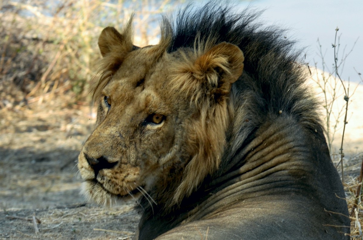
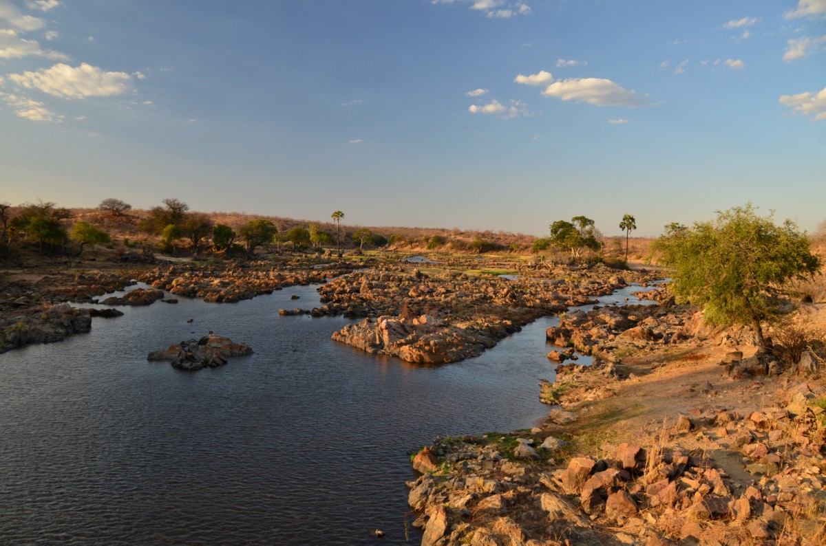
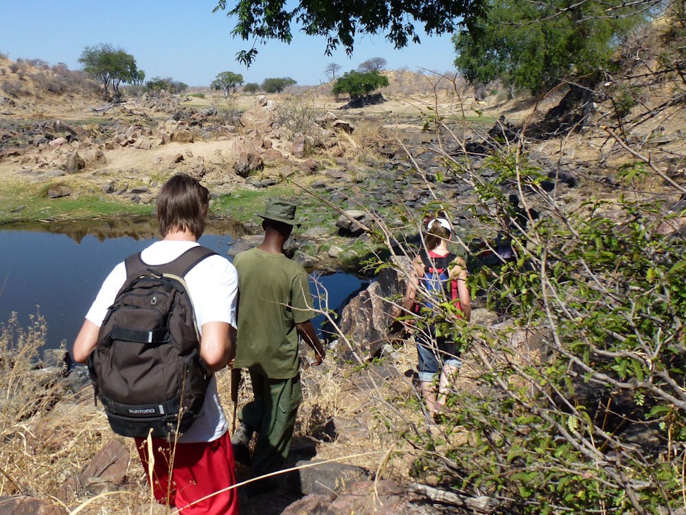
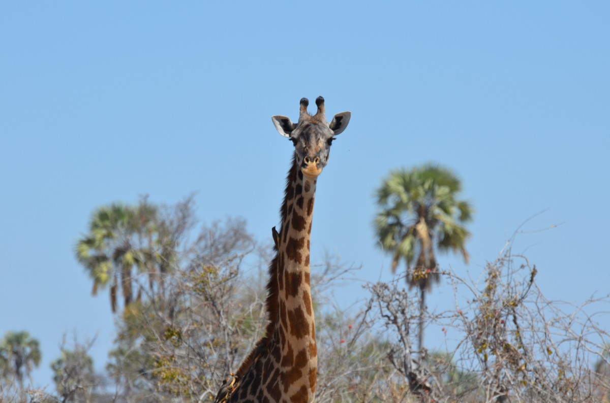
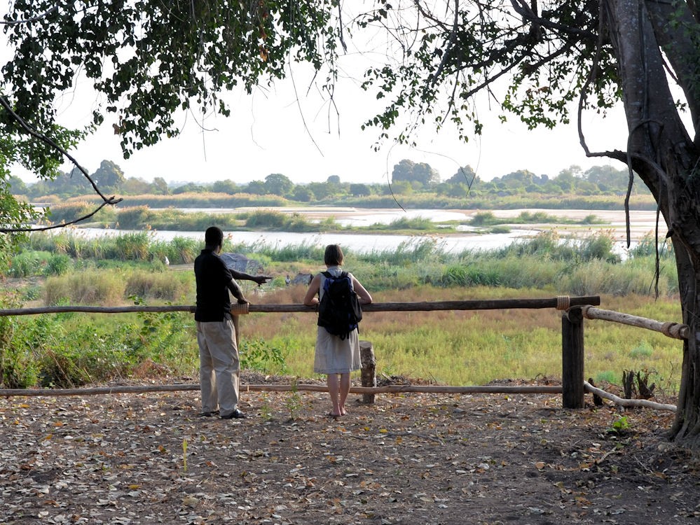
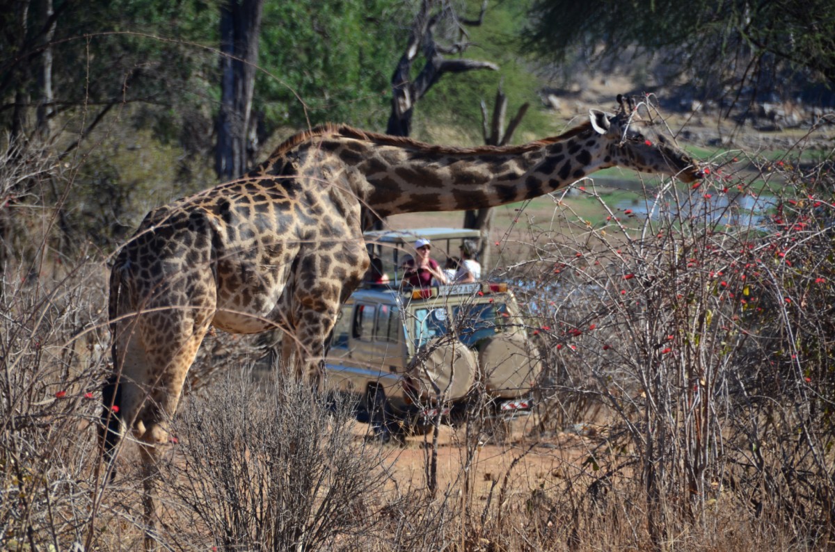
Ruaha National Park
Since its expansion in 2008, Ruaha is the largest national park in all of eastern Africa. even larger than Serengeti National Park with an area of about 20,226 km². Despite its size, the park is not yet as heavily frequented – and therefore a insider tip, as it is considered one of the most beautiful parks in Tanzania.
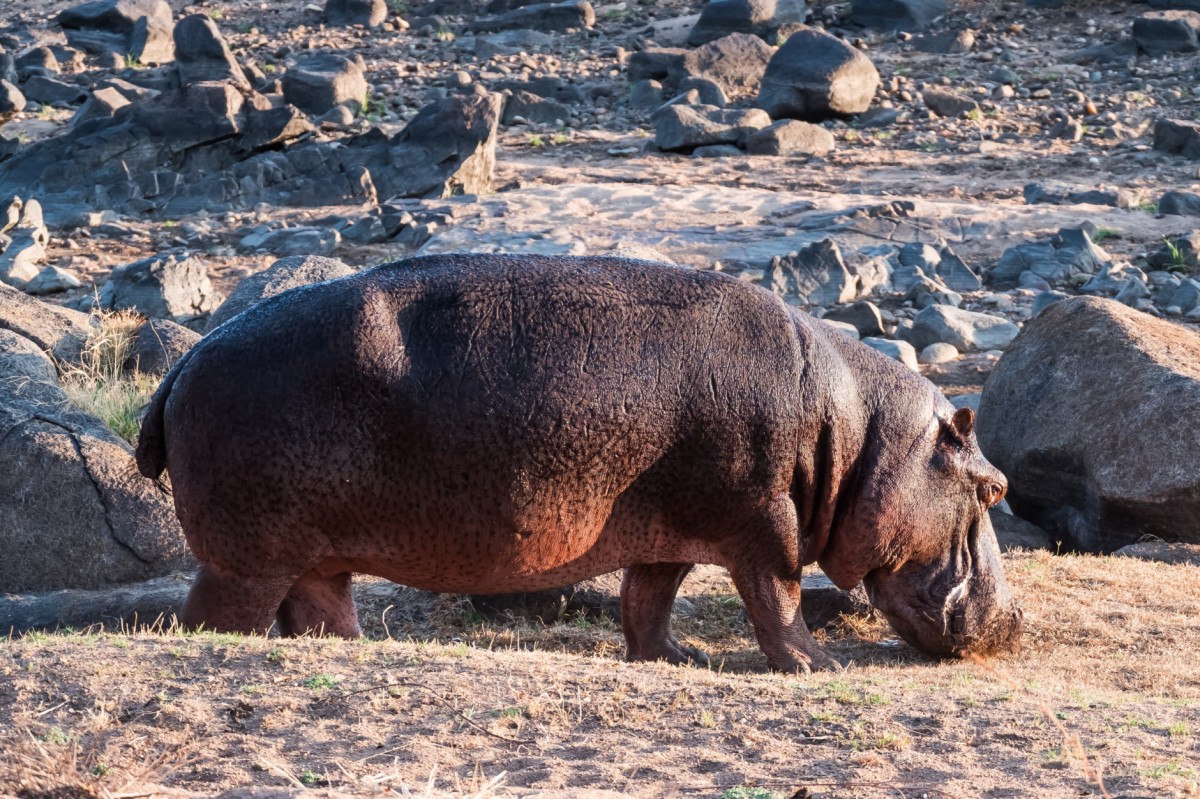
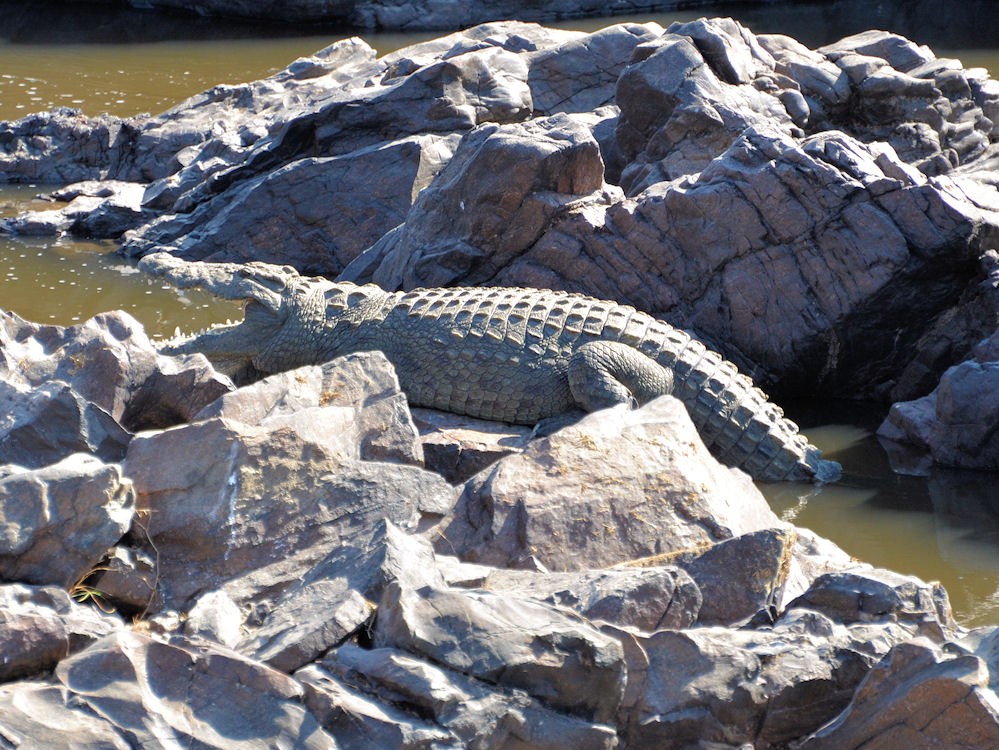
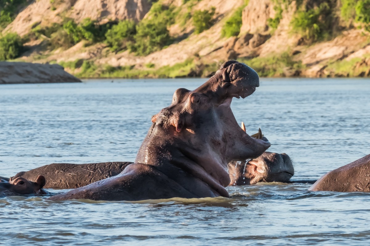
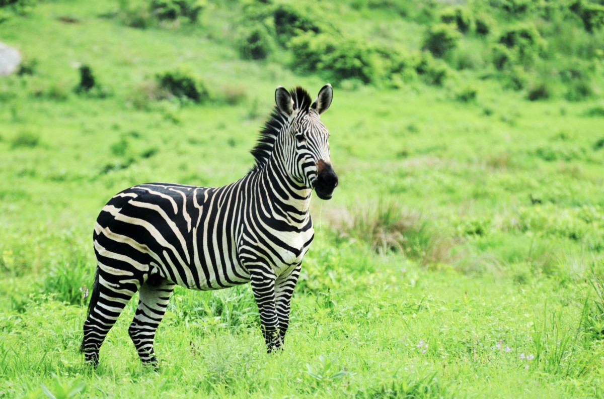
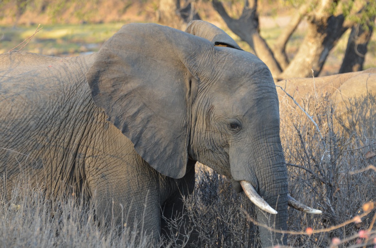
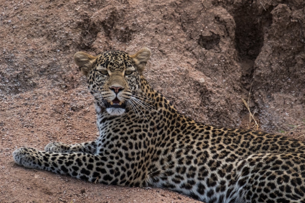
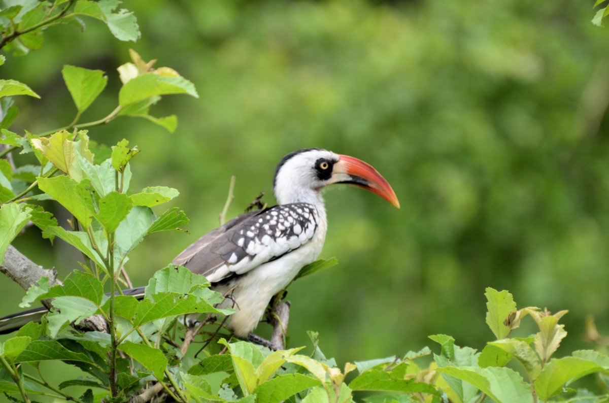
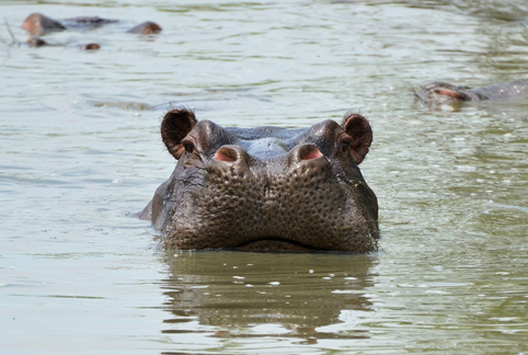
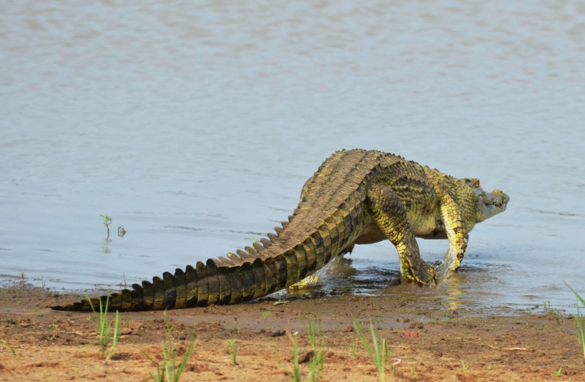
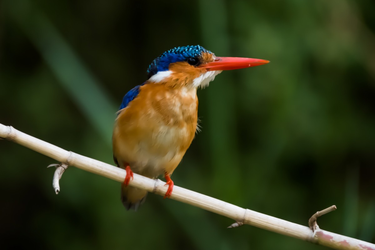
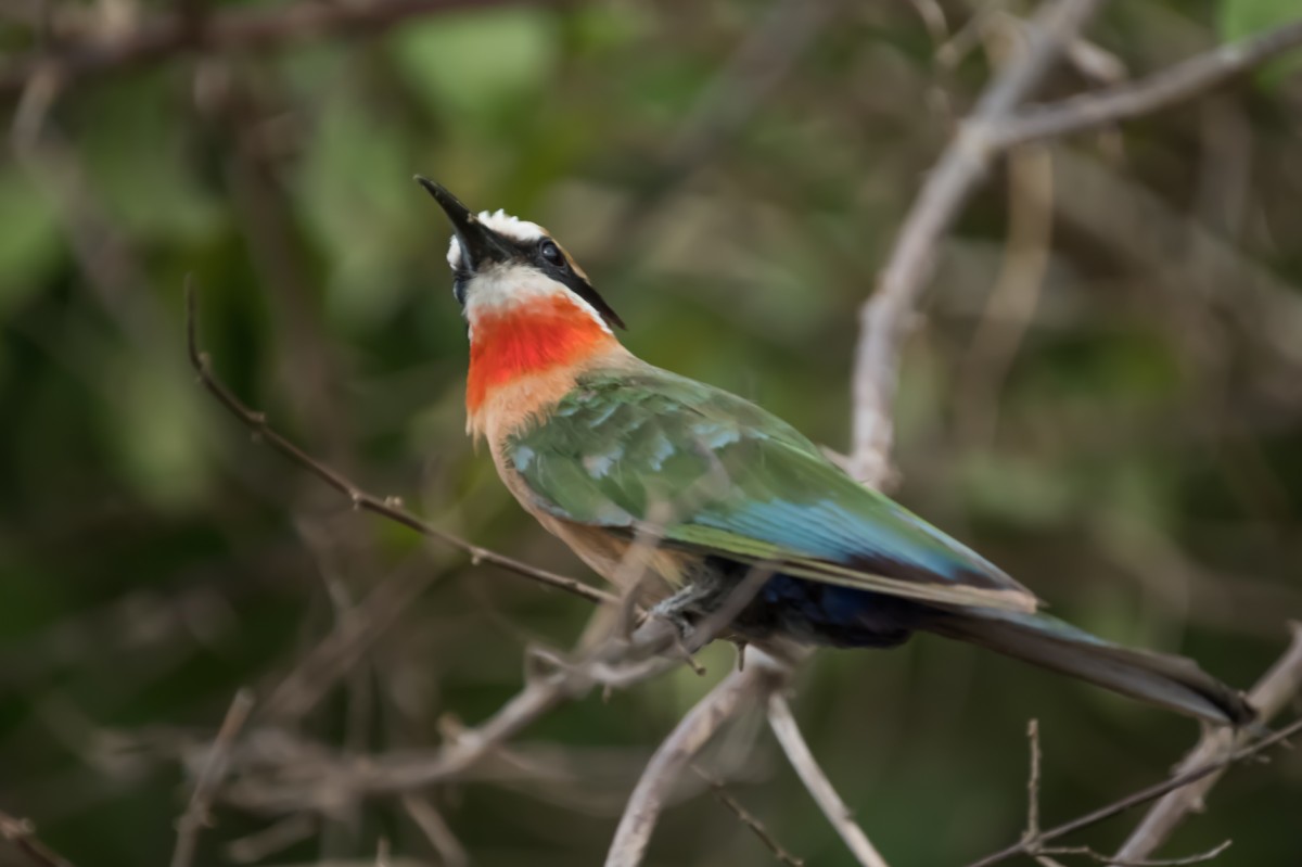
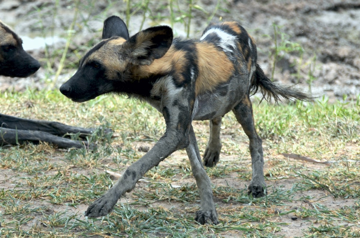
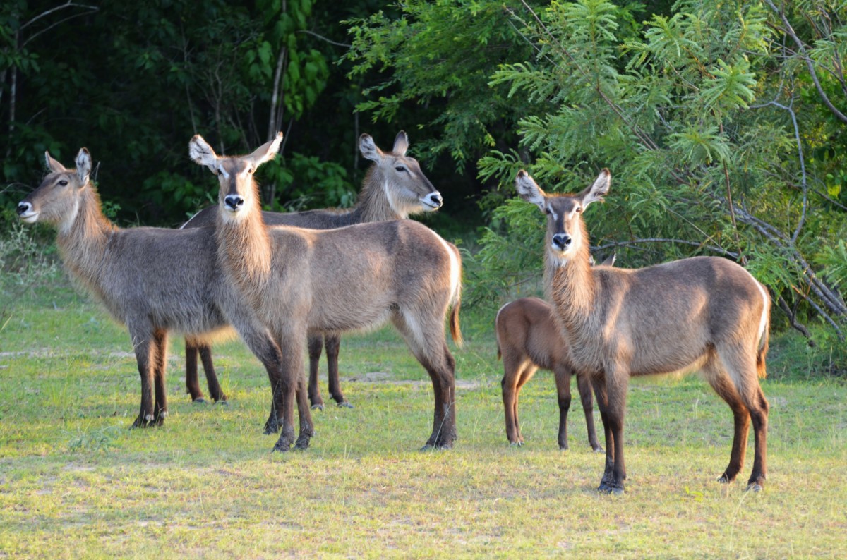
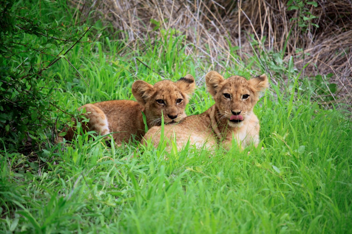
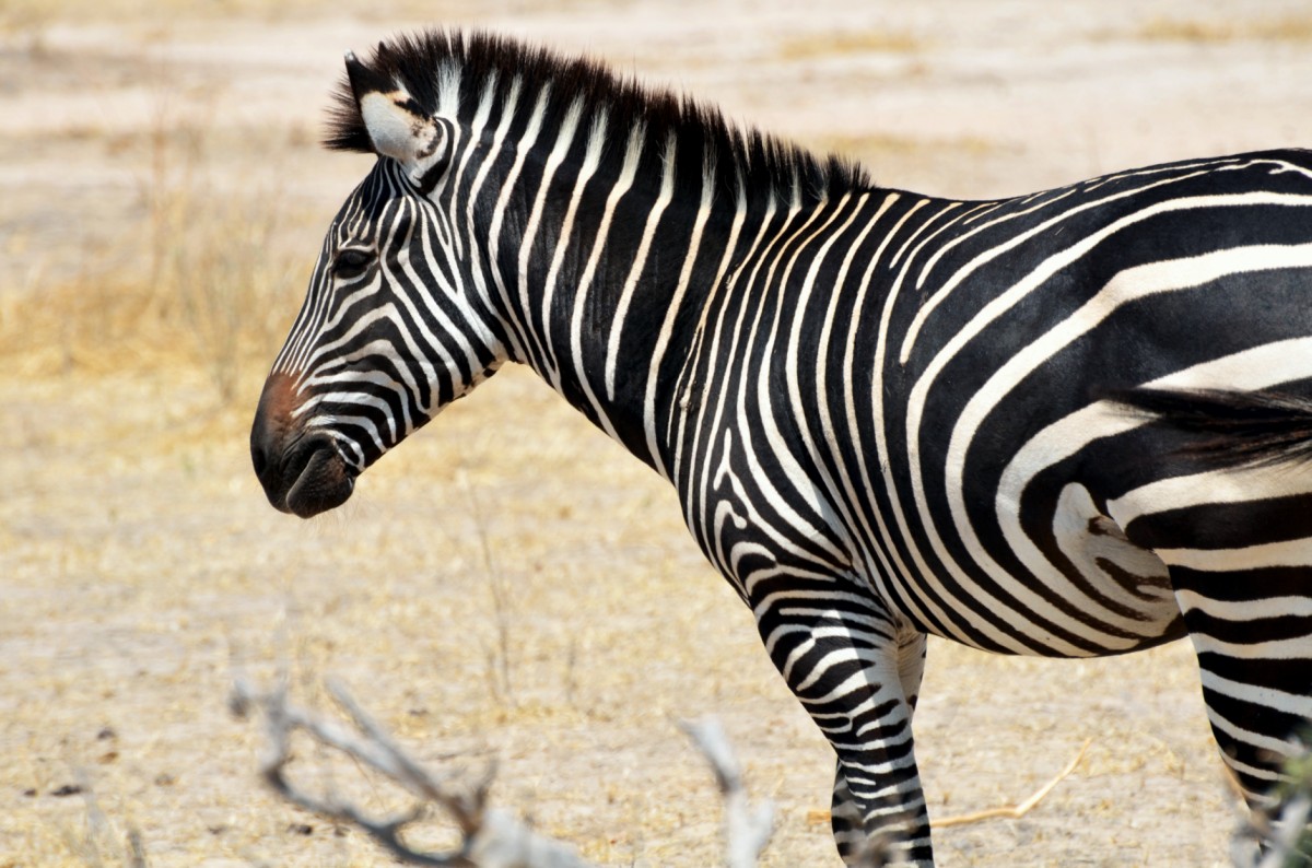
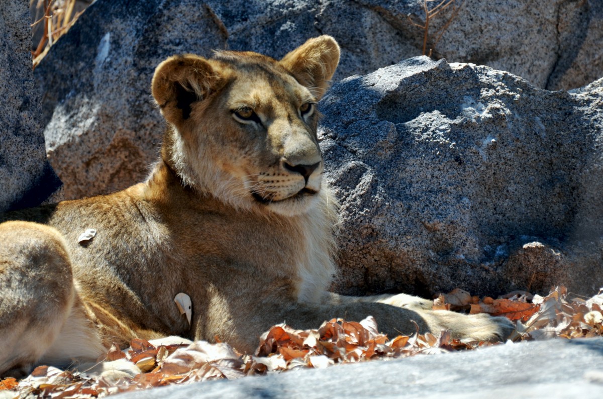
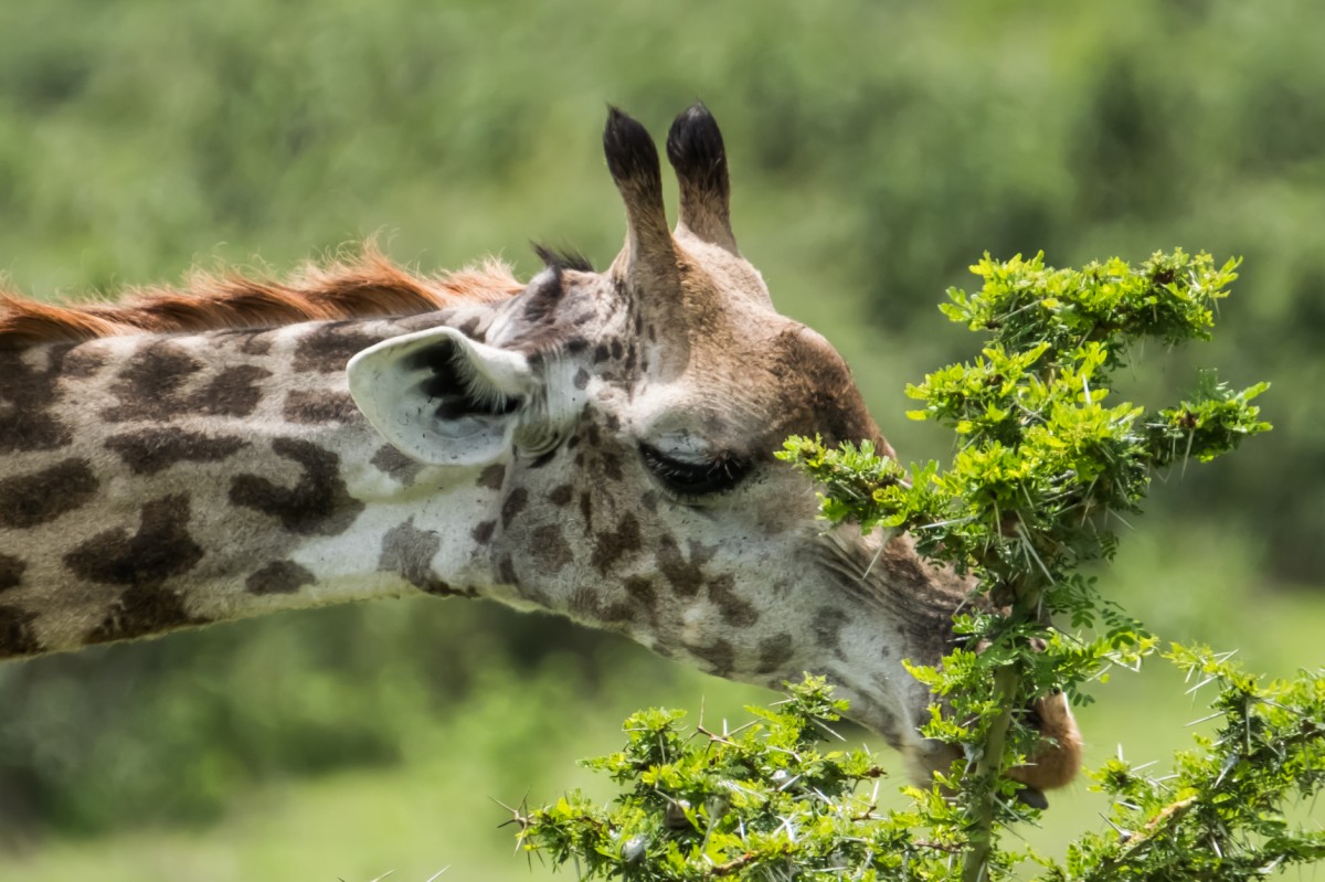
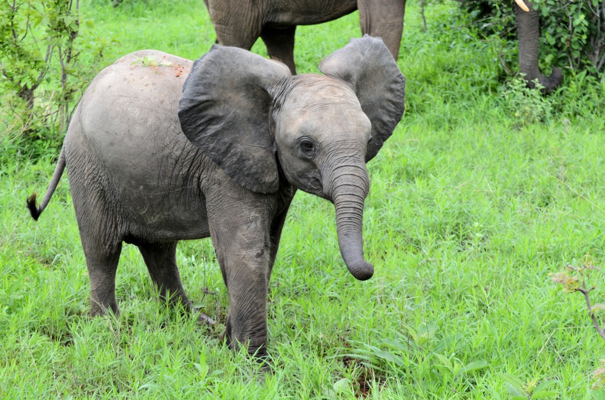
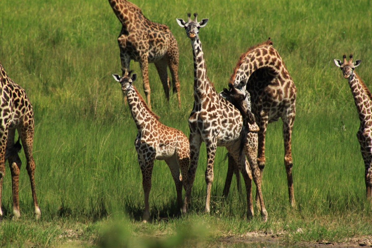
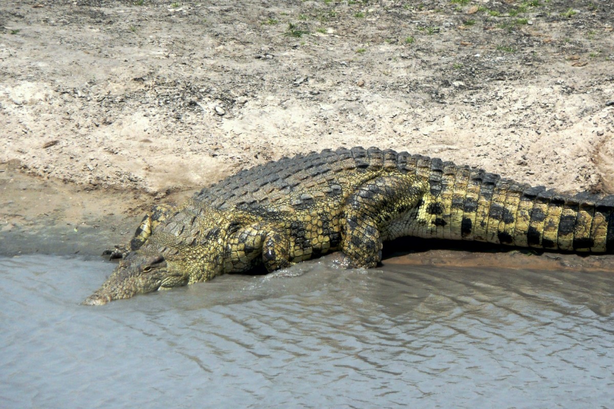
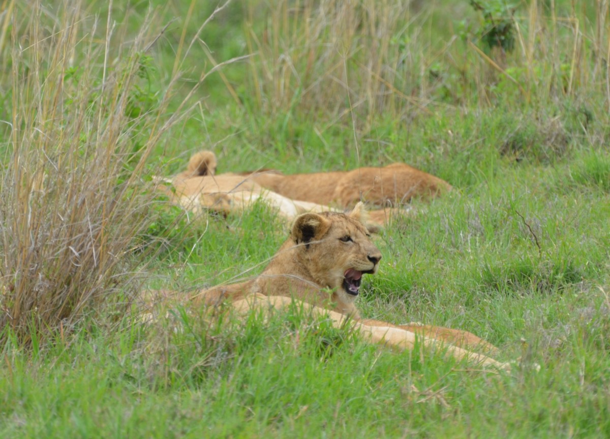
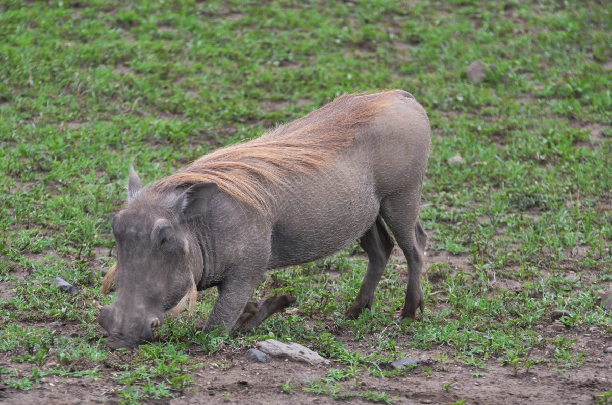
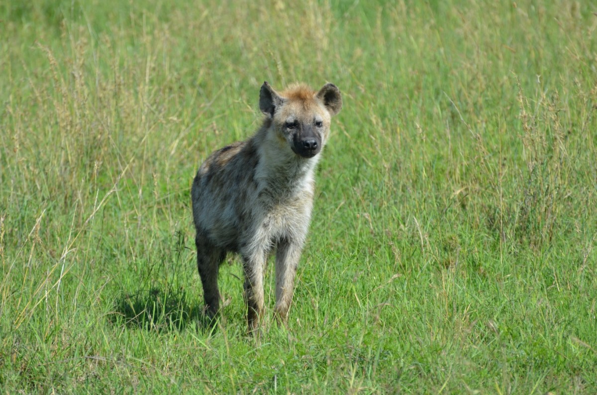
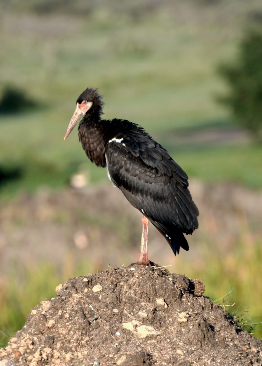
The park’s landscapes change from savanna to deciduous forests, providing shelter for a wide variety of animals. Giraffes, zebras, several antelope and gazelle species, spotted hyenas, big cats, and even the endangered African wild dogs can be spotted. Many birds from Eurasia pass by seasonally. However, the famous kingfishers, Charadriidae, and hornbills live at Ruaha all year. In total, more than 450 species of birds have been sighted. The heart of the park is Ruaha River with its pools and twisted river branches, where many hippos and crocodiles frolic. It is one of the most important sources of water for the animals during the dry season, as there are no more than 500 mm of rain per year. Despite harsh conditions, around 1650 plant species thrive here.
The best time to travel to Ruaha is between July to November when animals gather at the water holes because of the drought.
Images
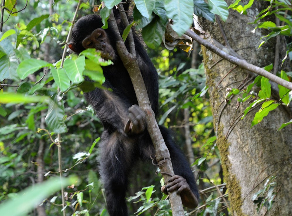
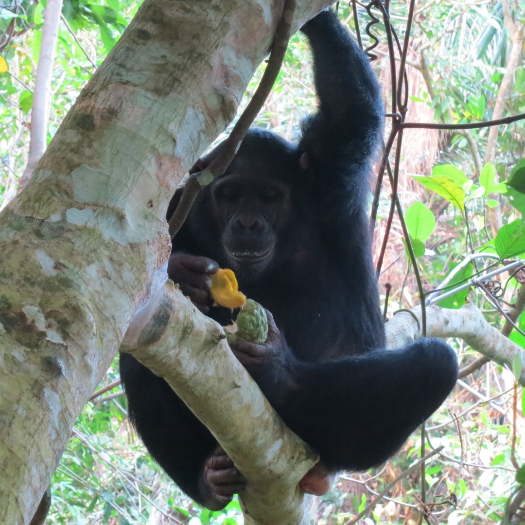
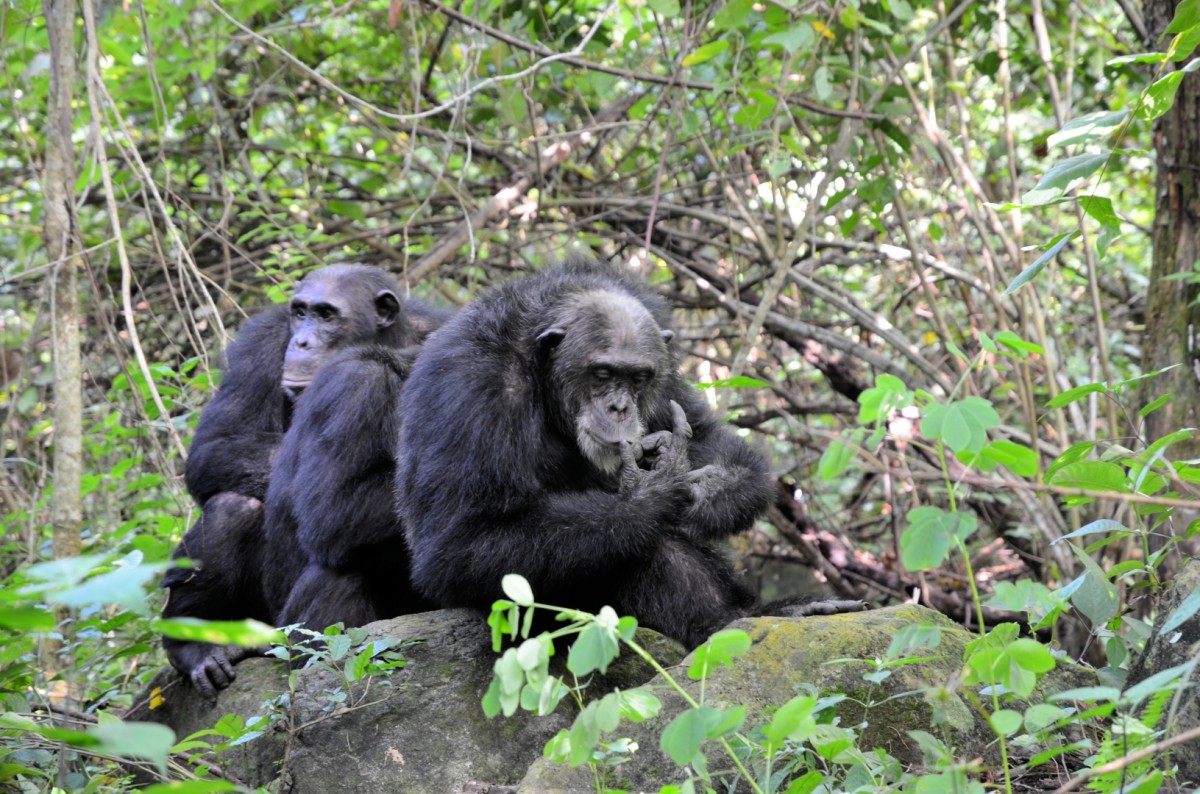
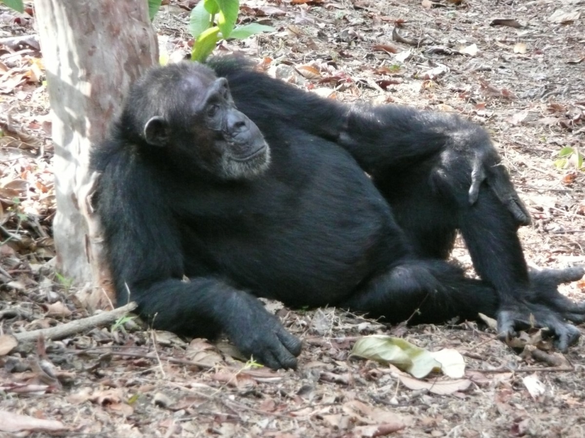
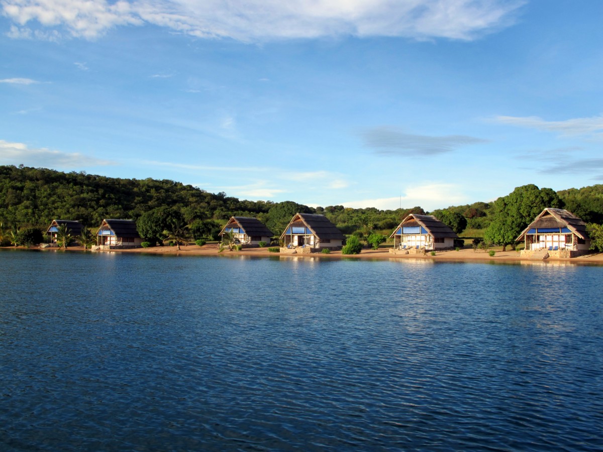
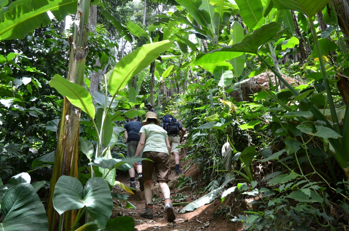
Mahale National Park
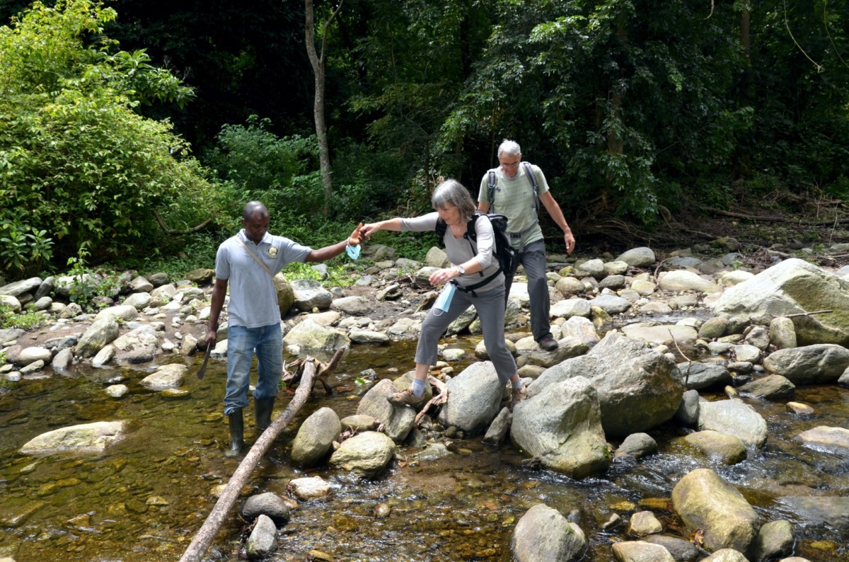
The Mahale mountains rise like a peninsula from Lake Tanganyika and form a reserve with an overall area of 1'613 km2. The mountains are a product of the East African Rift Valley and only accessible by water or air. In addition to direct access by a small plane, entry is also possible by boat.
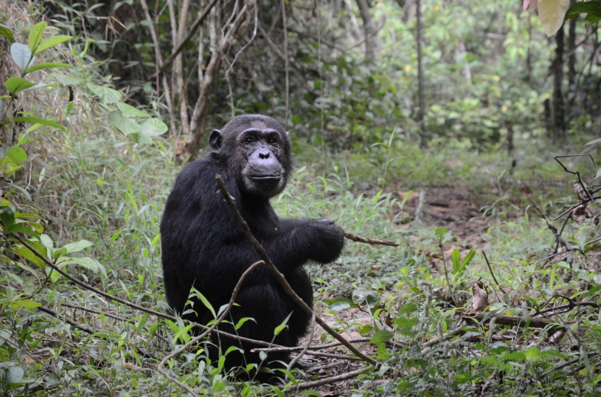
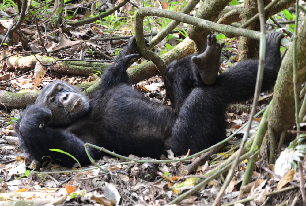
Evergreen rainforest stretches from the lakeshore on the mountain slopes, and eventually turns into a humid tropical mountain forest with dense bamboo. The Mahale mountains are home to about 1'000 chimpanzees and plenty of big game in the eastern drier part of the park. The population of primates has risen sharply with the establishment of the park. Previously, the apes had been exposed to poaching. Japanese primate researchers have been working in the region since 1961. With their many years of study in this isolated area, they have contributed a great deal to the founding of the national park. The researchers allow tourists to observe these fascinating creatures, who share 98.5% DNA with us. An encounter with the muscular athletes is a unique experience.
Images
Selous/Nyerere National Park
The Nyerere National Park is the largest national park in Tanzania and one of the world's largest wildlife reserve. The total area of the park is 30,893 km2 (11,928 sq mi) and covers the Matemwe, Morogoro, Lindi, Mtwara and Ruvuma regions. Much of the area is in a natural state without being disturbed by human activities. The national park was created in the northern parts of the Selous game reserve in 2019 and got its name in honor of the founder of the state and first president of Tanzania Mwalimu Julius Nyerere.
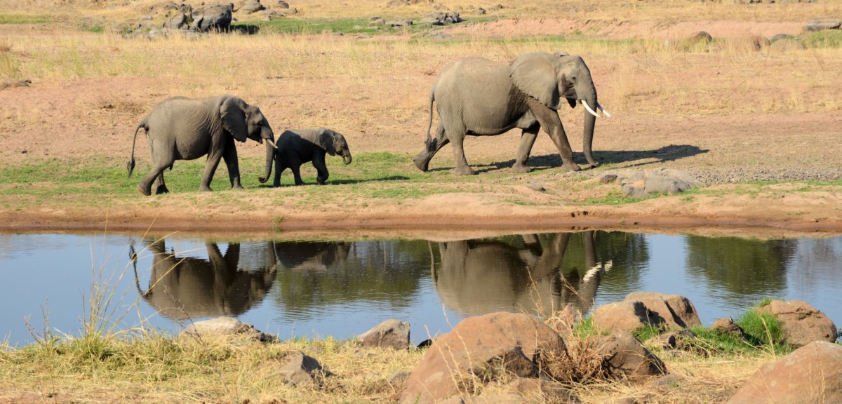
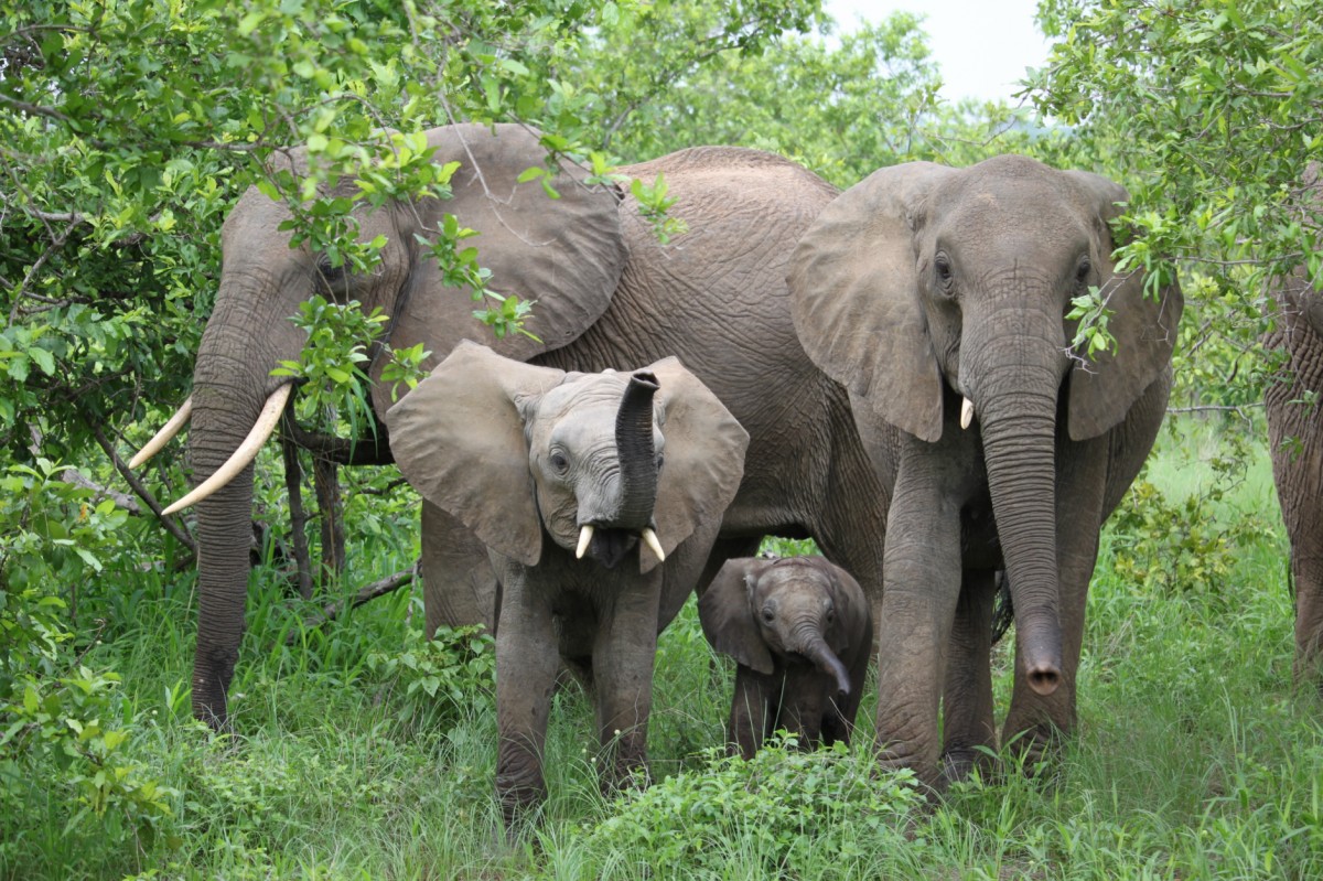
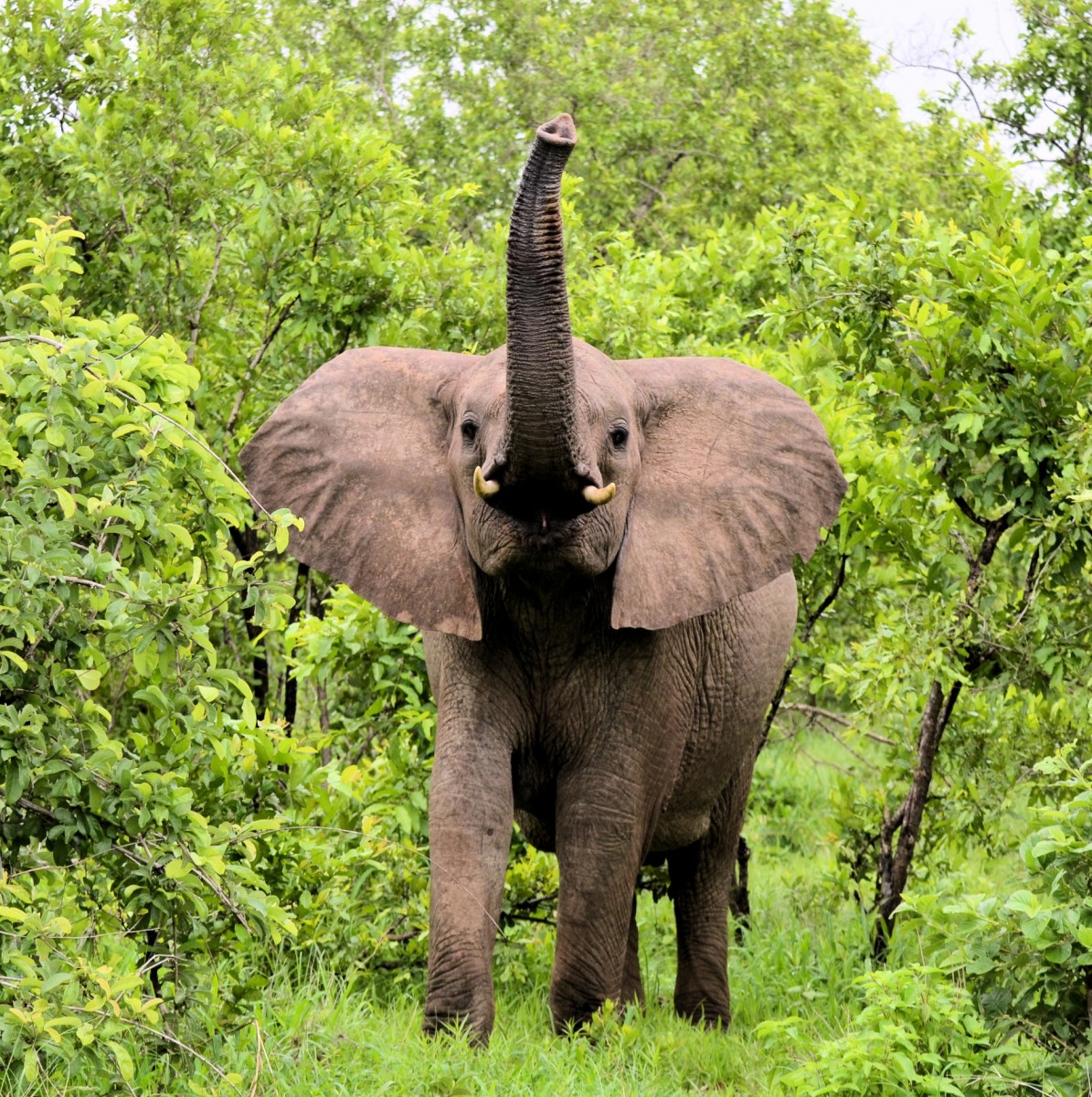
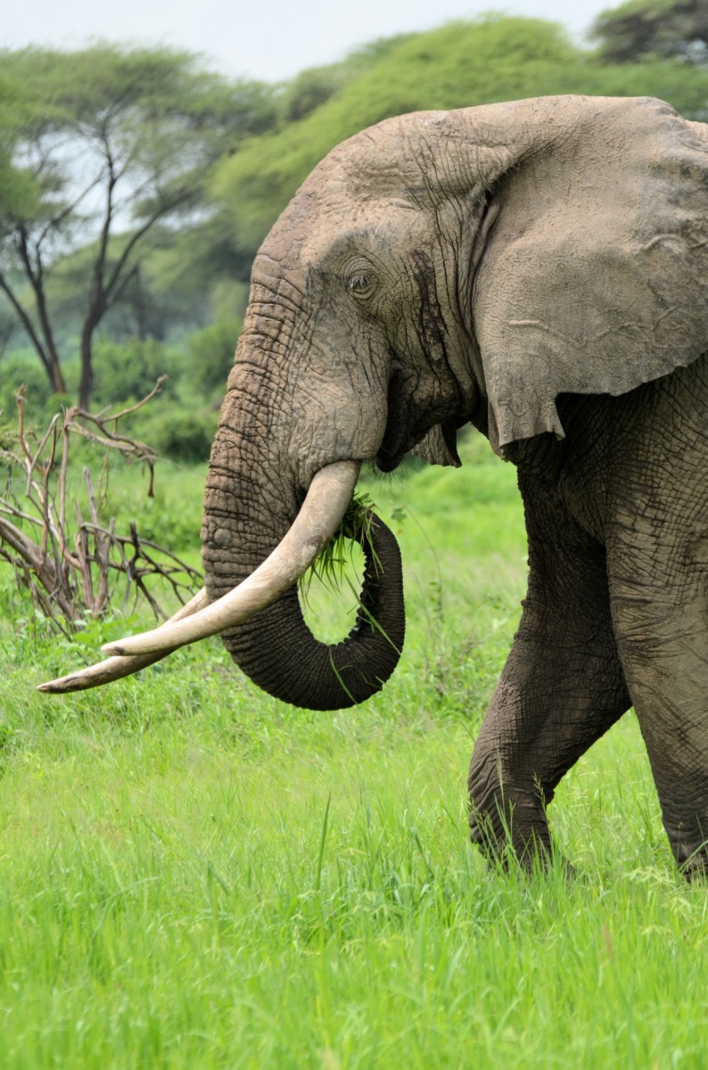
The Selous Game Reserve, adjacent to the south of the Nyerere National Park, was named after the famous explorer Frederick Courtney Selous, a great naturalist, environmentalist, and hunter. The Selous was declared a World Heritage Site by UNESCO in 1982 and, with 54,600 km² (1.3 x land area of Switzerland), is the largest game reserve in Africa. It houses about a sixth of all elephants living in Africa and provides shelter for the rare bat-eared foxes. Unfortunately, over the course of the last 20 years many elephants and the few remaining rhinos have been poached. Fortunately, with the election of the former President John Magufuli, poaching has declined sharply since 2016.
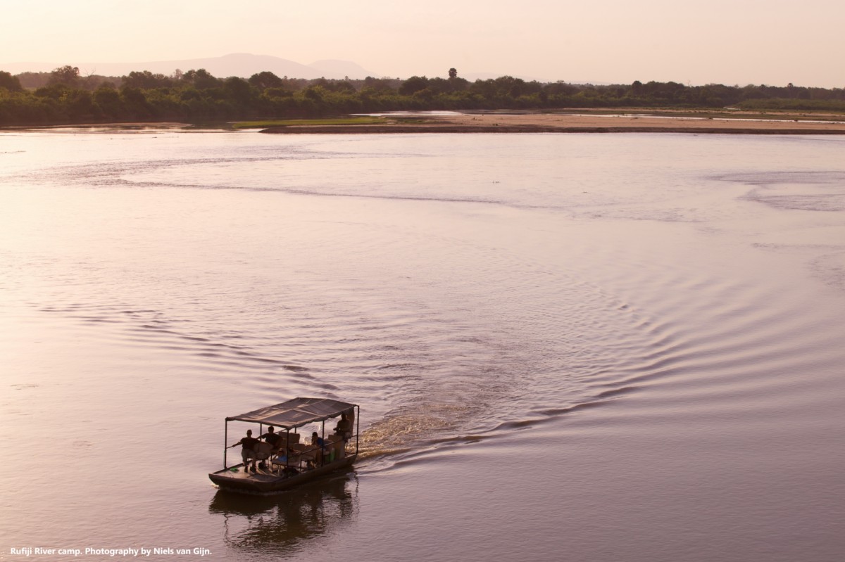
For visitors, only the northern tip of the park is open. It is a fascinating and abundant wilderness, accessible along the island- and lake rich Rufiji River. We therefore recommend taking boat tours through the labyrinth of creeks and lakes, short walks with a ranger, or discovery tours through the bush with a local resident. Large parts of the Selous Game Reserve are covered by Miombe forests. The other areas of the reserve consist of wooded and open grassland.
Images
Tarangire National Park
Tarangire National Park is what you might see, when you picture "Africa": Golden brown grass and shrubby savannahs, prickly acacia forests, and endless hills create a genuine bush feel.
The park is located two hours west of Arusha on the road to Serengeti, and is easily accessible and much frequented.
The park owes its name to Tarangire River, which winds its way through the park from north to south. In many places, however, the river is dry during dry season months, while water continues to flow underground. Elephants use their trunks to dig deep holes in the sandy riverbed to access the precious drink of water. In places where the water flows year-round, the river is lined by dhoum and borrassus palm trees and dense gallery forest which provides nesting sites for many birds.
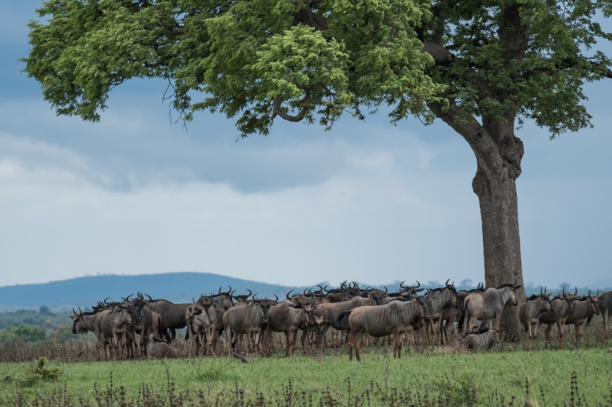
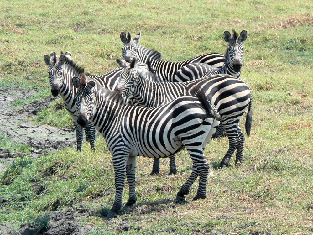
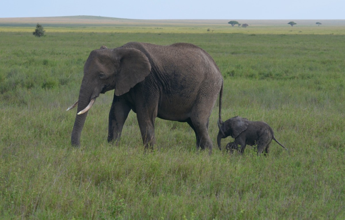
The annual small migration during the dry season is unique to the Tarangire national park. Towards the end of the dry months (July to October), many animals from the surrounding ecosystems migrate to the river to ensure their survival. Countless elephants, gnus, zebras, Thomson's gazelles, Grant's gazelles, buffalo herds, common elands, hartebeests, and the rare beisa oryxes are playing in the water and nearby waterholes. All delicate antelopes and gazelles are on the menu of many lions and hyenas, who spend these months at the park, as well.
Images
Mikumi National Park
The Mikumi National Park borders Africa's largest game reserve - the Selous. The park is divided in the north by the connecting road from Dar es Salaam to Iringa. This road provides the easiest and fastest access to the wilderness of the park near Dar es Salaam.
The abundant wildlife of the Mkata Flood Plain, the heart of the Mikumi, can be compared to the famous Serengeti plain. The park is known for the occurrence of large buffalo herds and a high number of lions. These overlook their kingdom from the flat tops of termite mounds. Zebras, gnus, and impala populate this empire; Giraffes loot acacia trees that line the Mkata River, and these trees are also beloved by elephants.
Crossed by safari trails, the Mkata Plateau is probably the most reliable place to sight the powerful eland, the largest antelope in the world. The larger Kudu and the sable antelope prefer the Miombo forests at the foot of the mountains along the park boundary.
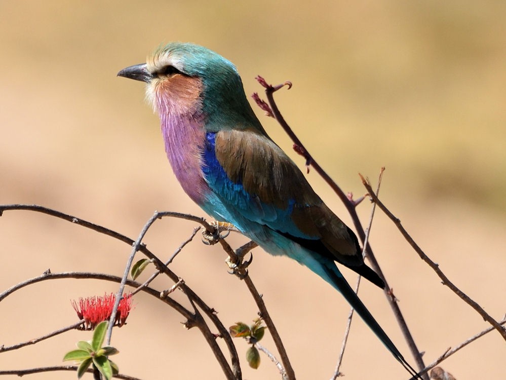
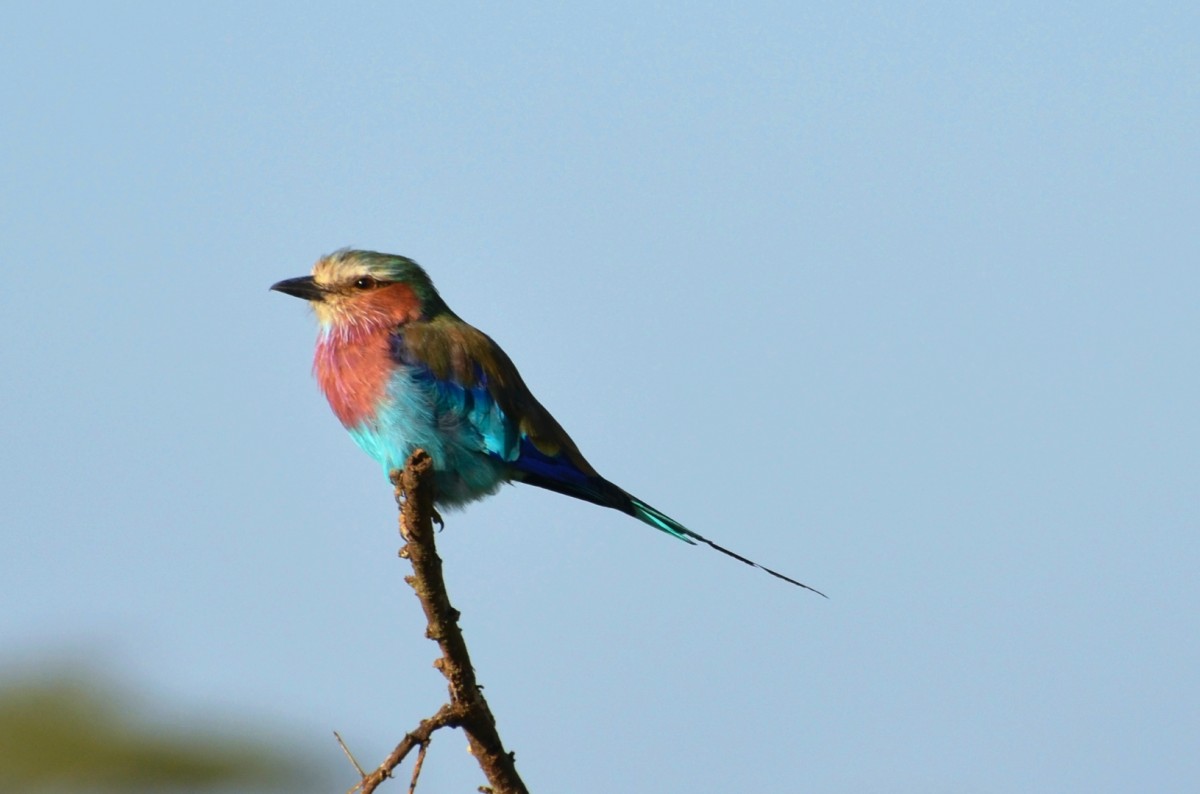
More than 400 species of birds were counted, including threatened species such as the lilac-breasted roller, the yellow-throated longclaw, and bateleur eagle. Hippos frolic in the pools 5 km north of the main entrance along with crocodiles and schools of various waterfowl.
Images
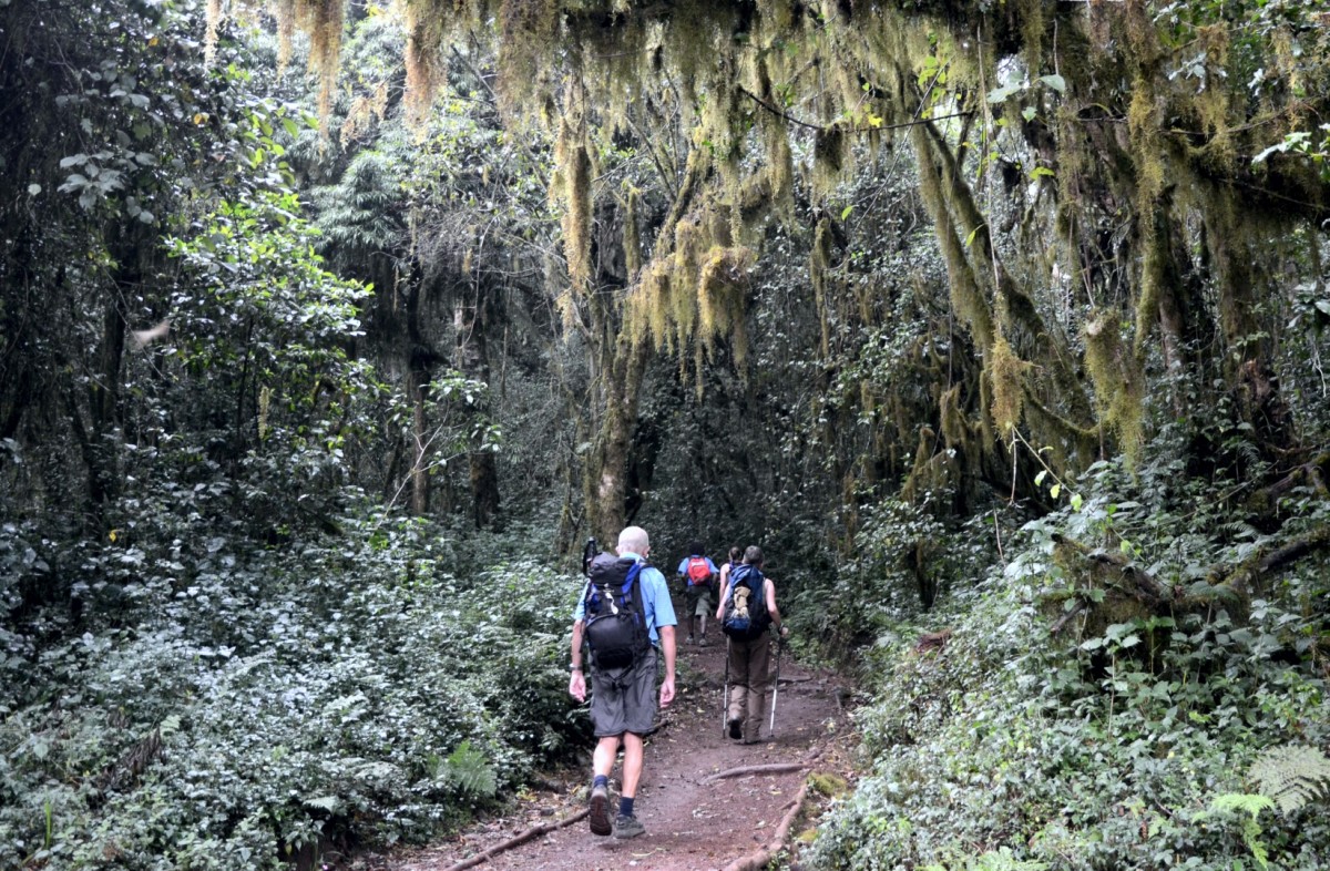
Udzungwa National Park
Udzungwa is one of the most diverse and species-rich mountain regions. Many indigenous species call it home. The area is often referred to as "African Galapagos Islands". One of many endemic plants and animals is the petite African violet.
The mountains are part of the Eastern Arc Mountains which formed around 200 million years ago. The dense forests rising at altitudes from 250m to 2000m are unique to Tanzania.
Bird lovers will thrilled about the park’s abundance of birds. There are more than 400 species, including green-headed orioles and more than a dozen local species. The woodhen was first discovered at Udzungwa in 1991; it resembles its Asian relatives more than its African counterparts.
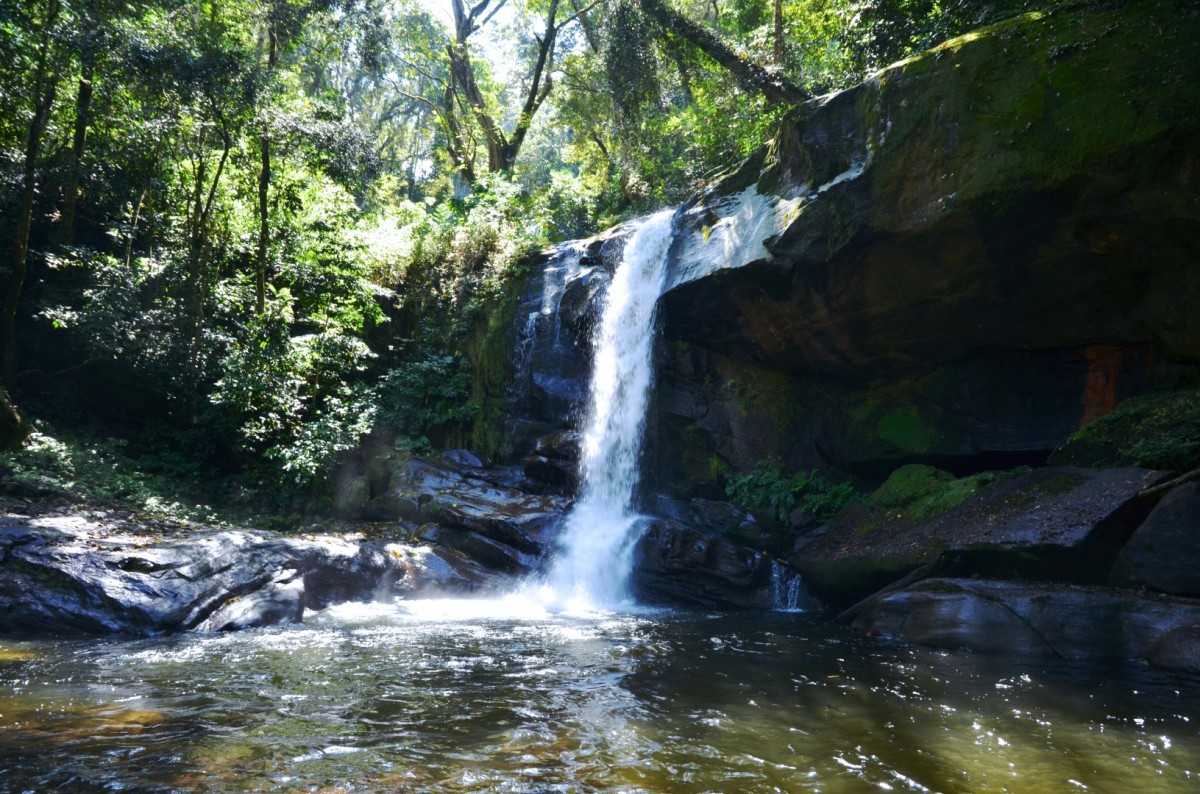
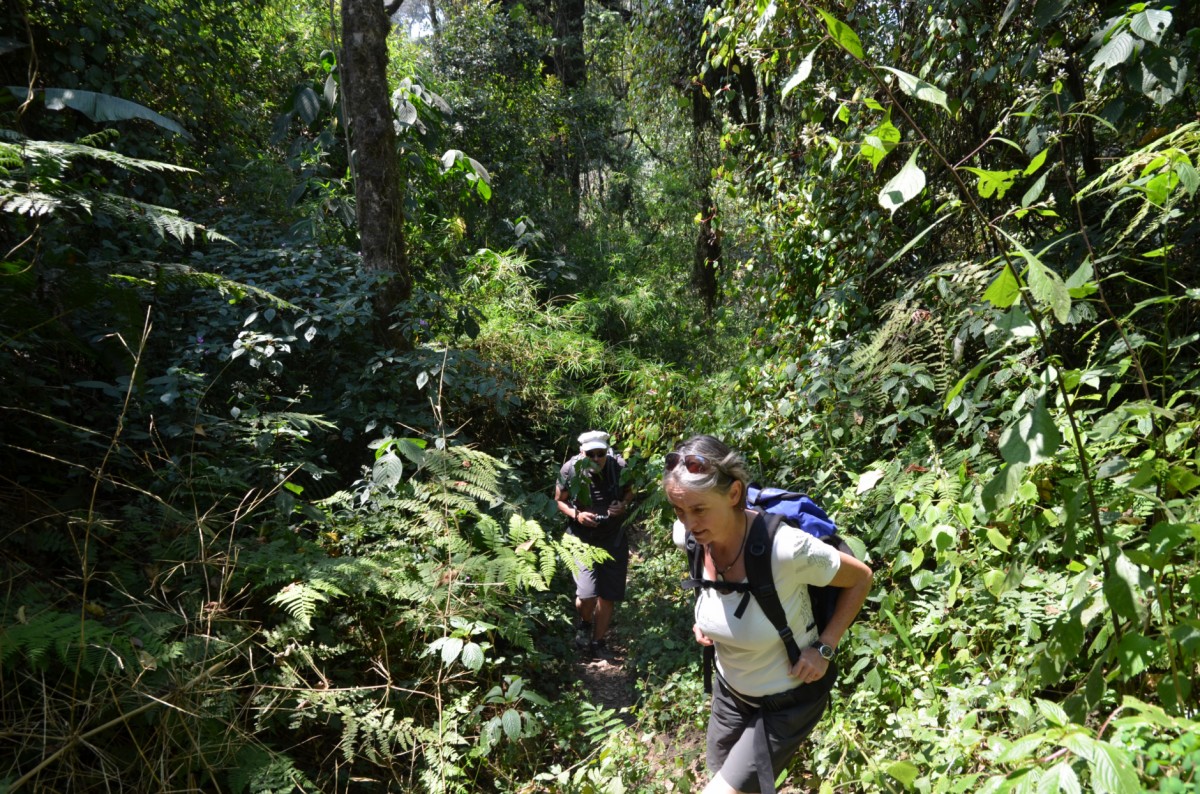
The park also attracts hikers, as it boasts great forest trails. Explore the local flora and fauna on foot and under expert guidance. This slow way of getting to know the rainforest opens eyes and ears. A beautiful half-day hike leads to the Sanje waterfall, which plunges 170 meters into the valley and offers a fantastic view. The more challenging two- to three-day Mwanihana treks lead through dense forests on a high plateau and up to the peak of Mwanihana, the second highest in the mountain range. Hikers spend the night at tented camps at an altitude of around 1,600 m above sea level.
Images
Lake Manyara National Park
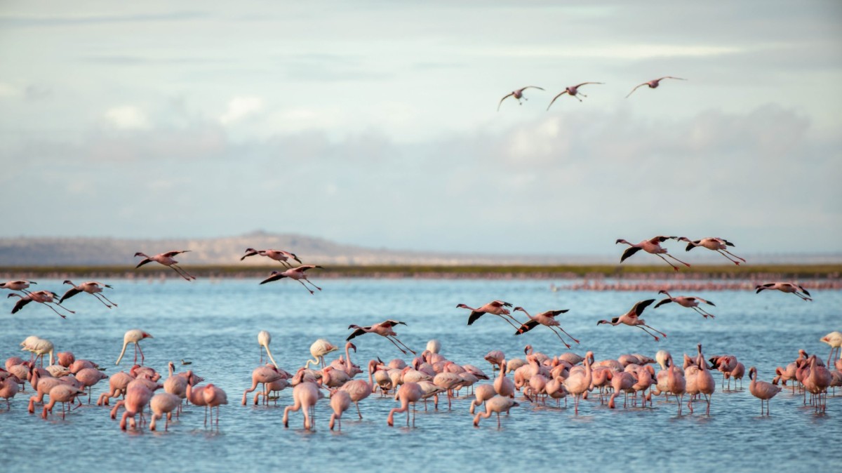
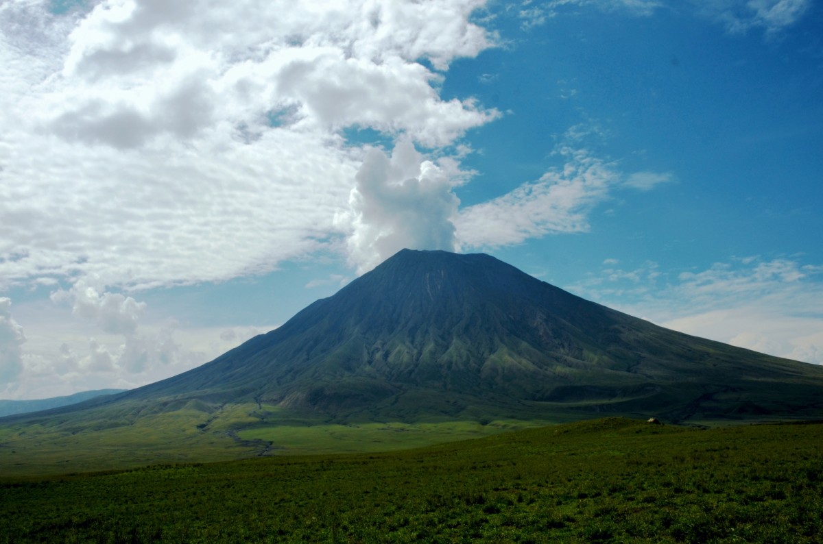
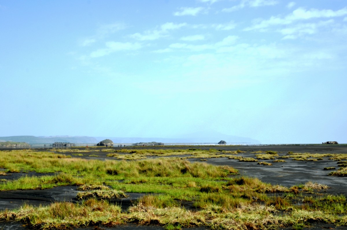
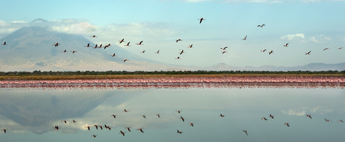
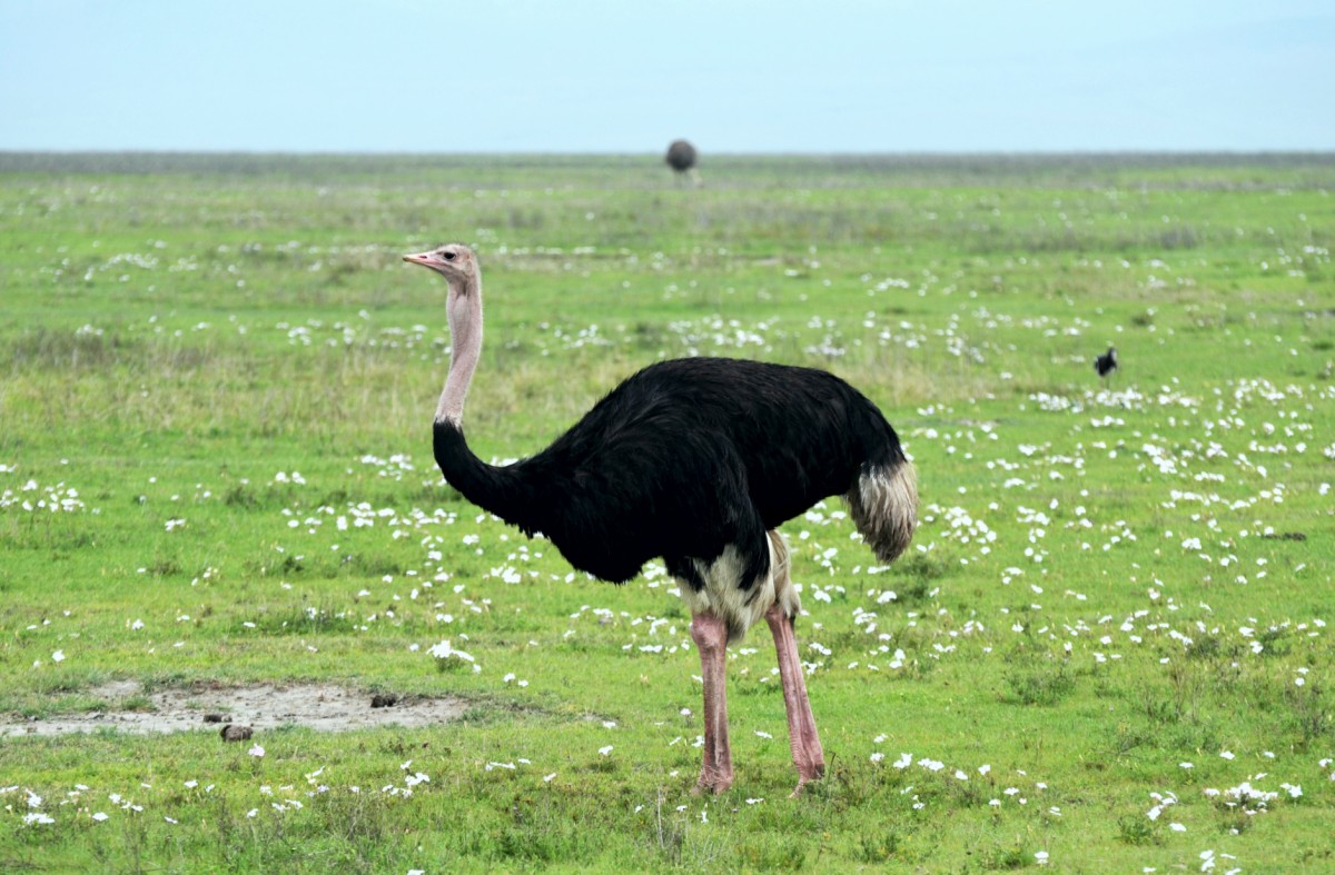
Lake Natron is located in the Maasai region of the East African Rift Valley system and is surrounded by volcanoes. Ol Doinyo Lengai is the only active volcano in Tanzania, all others are dormant. Volcanic rocks, ash, and high evaporation are responsible for the soda-rich water of the lake, which can reach a pH-value of up to 12. The surface of the only 0.5m-deep lake varies between 1'000 km2 in the rainy season and a few square kilometres towards the end of the dry season. What remains is a crust of white salt crystals. Purple bacteria turn the water surface blood-red. The same bacteria are responsible for the coloration of lesser flamingos, who absorb them with their food. Lake Natron is the most important breeding ground for lesser flamingos in Africa. From July to October, up to 2 million animals are breeding here. They often to build their nest mounds of mud in a place where people have no access. Even for animal enemies, such as hyenas, the breeding area is inaccessible. During the rainy season (March to June), the otherwise desolate stone desert around the lake is transformed into lush pastures that provide food for gnus, zebras, ostriches, and the cattle of the Maasai.
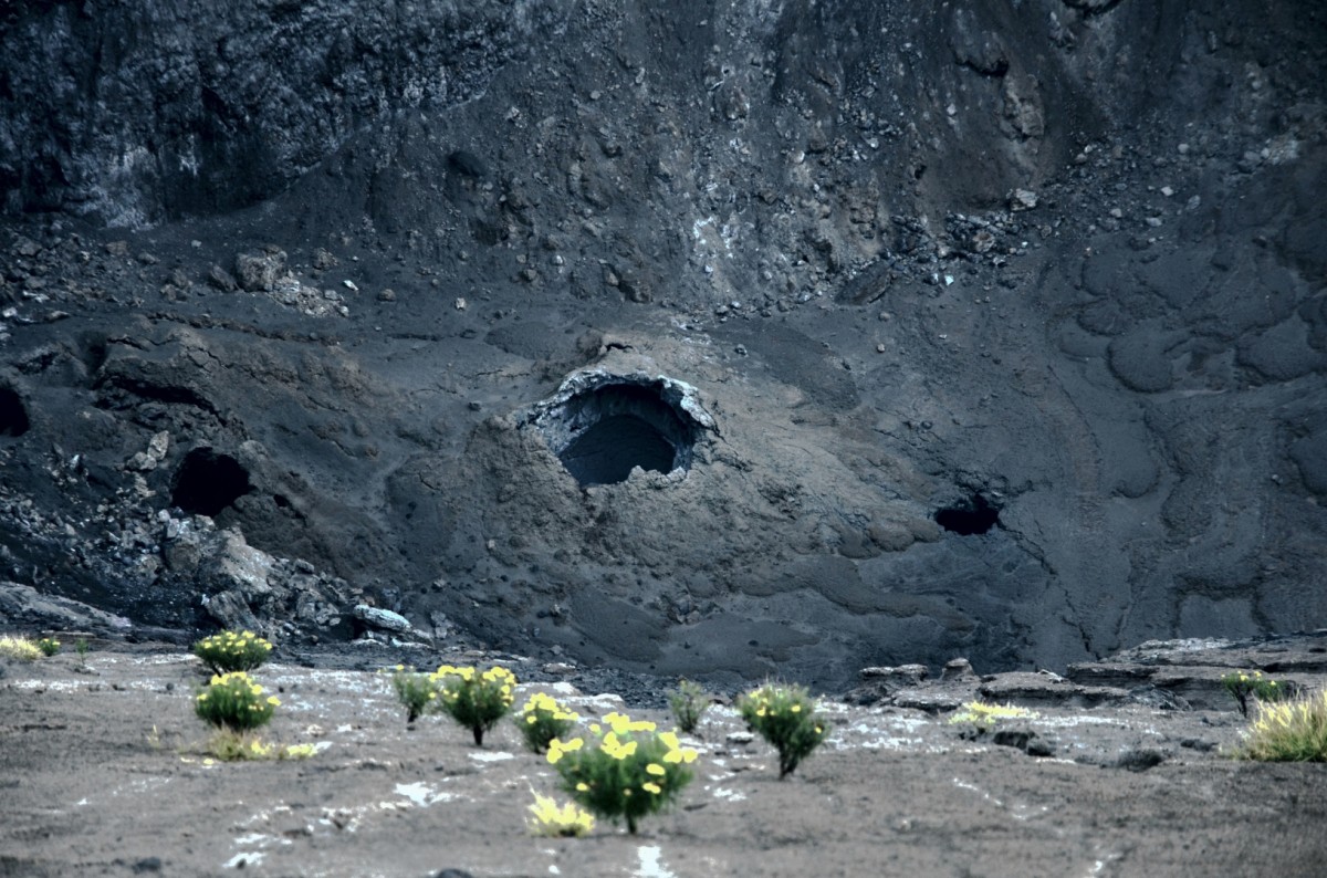
The ascent to Ol Doinyo Lengai is reserved to adventurous, experienced, and responsible hikers. The path leads along gullies dug into the deposited lava and ash deposits. The hard, six-hour ascent is rewarded with a wonderful view. Sulphurous clouds of smoke rise from holes, and you can hear and see the lava seething inside the crater. The most recent eruption of the volcano was in 2010.
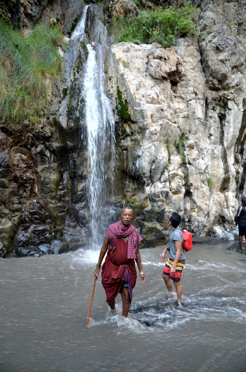
The hike to a waterfall, where you can treat yourself to a cooling shower, is easier and shorter. The creek has dug a gorge in the volcanic rocks through which you will be able to access the waterfall.
Further tours are offered to hot springs, the recently discovered footprints that may be more than 120'000 years old, or to one of the surrounding Masai bomas.
Images
Katavi National Park
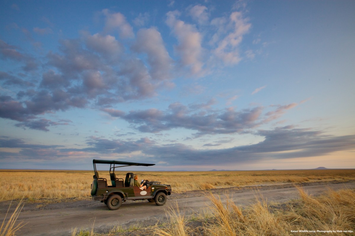
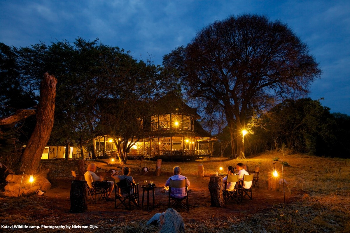
Katavi National Park was established in 1974, and is located at approx. three hours from Lake Tanganyika. It was built at the initiative of local residents and with the financial and technical support of the Zoological Society of Frankfurt.
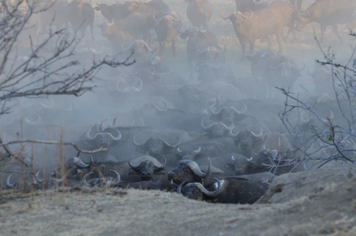
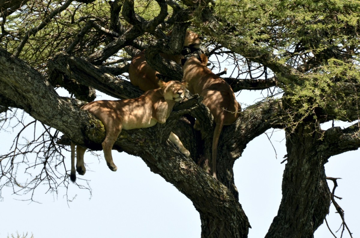
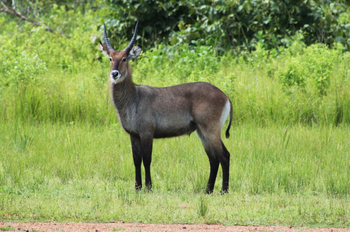
Katavi National Park is considered the most pristine, wild, and exciting Tanzanian national reserve. Reasons for why tourists do not come in droves may include the tsetse fly and the long journey it takes to get there. Huge herds of buffalo are the highlights of the park, along with hyenas, giraffes, zebras, eland, hippos, crocodiles, and waterbucks. With a little luck, you will see lions resting in trees at lunchtime.
Katavi National Park reveals original African wilderness. The reserve is surrounded by three bodies of water – by Katavi Lake to the north, Chada Lake in the southeast, and Katuma River to the south. This multifaceted area is home to more than 400 species of birds.
Images
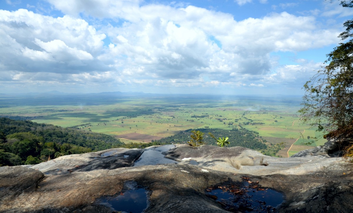
Kitulo National Park
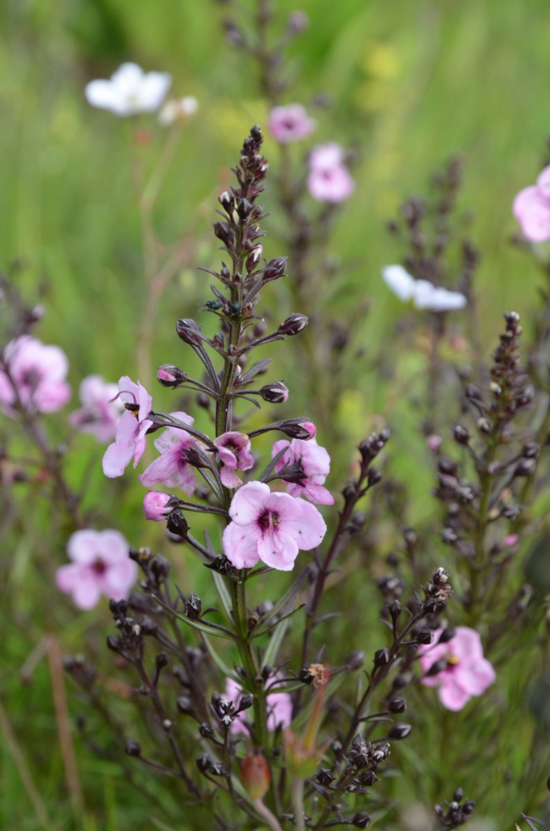
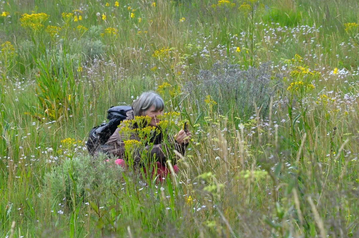
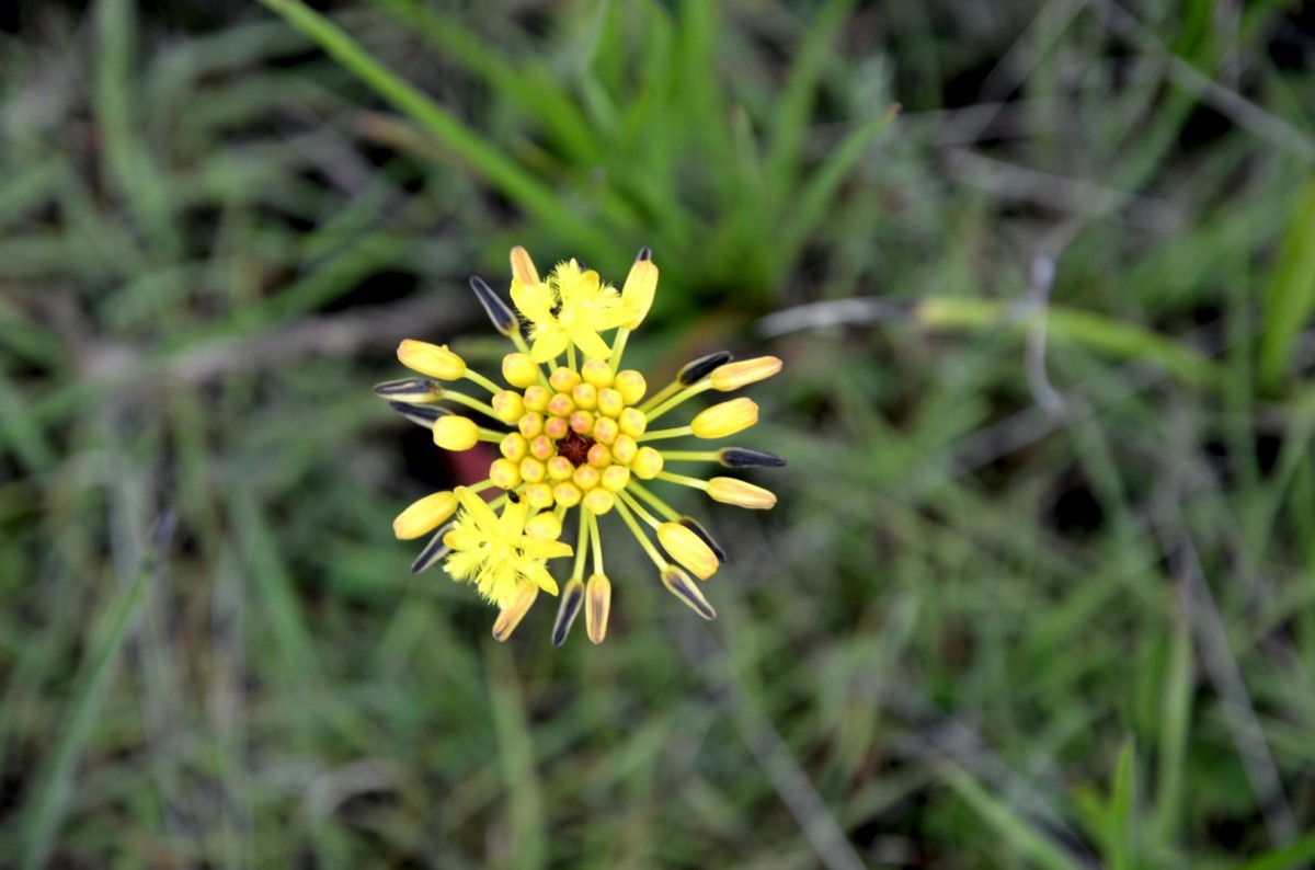
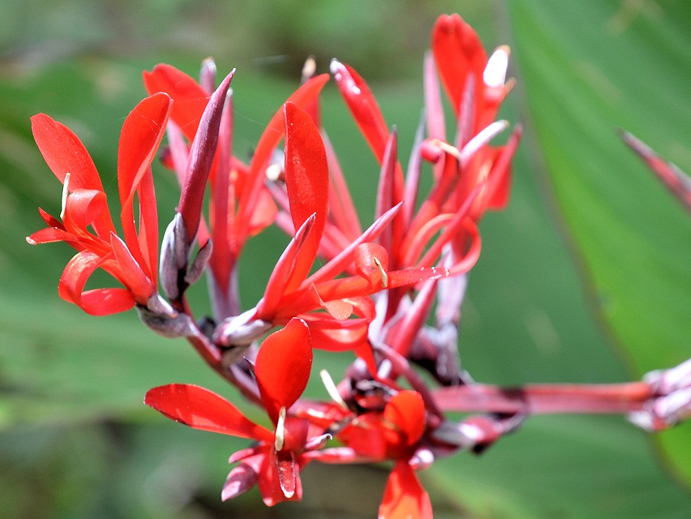
The well-watered and fertile Mount Kite sits between the jagged peaks of the Kipengere, Poroto, and Livingstone mountains, at 2,600 meters above sea level. The locals call it "Bustani ya Mungu" (garden of God), while botanists dubbed the plateau “the Serengeti of Flowers”, as it provides one of the most spectacular floral spectacles in the world. In fact, Tanzania's newest national park is a botanical gem: As many as 350 vascular plant species, including 45 different land orchids, grow here. In addition, beautiful yellow-orange, red hot pokers, and a selection of aloes, sugarbushes, geraniums, and lilies can be found here. They transform the park into a fascinating sea of colours during the rainy season from December to March.
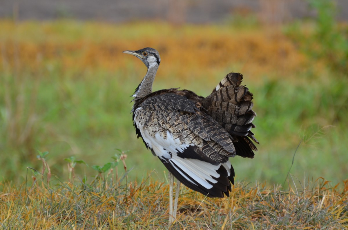
Kitulo, every botanist and hiker's paradise, also appeals to bird lovers. The park is home to Tanzania's only population of the rare bustard, and there is a breeding colony of threatened steel swallows, as well as true-to-life species, such as weaver birds, Nijombe cisticola, and Kipengere siskin. Butterfly species, chameleons, lizards, and frogs add to the biological wealth.
The ideal time for a visit is from December to February, when flowers are in bloom after the first rain in November
Images

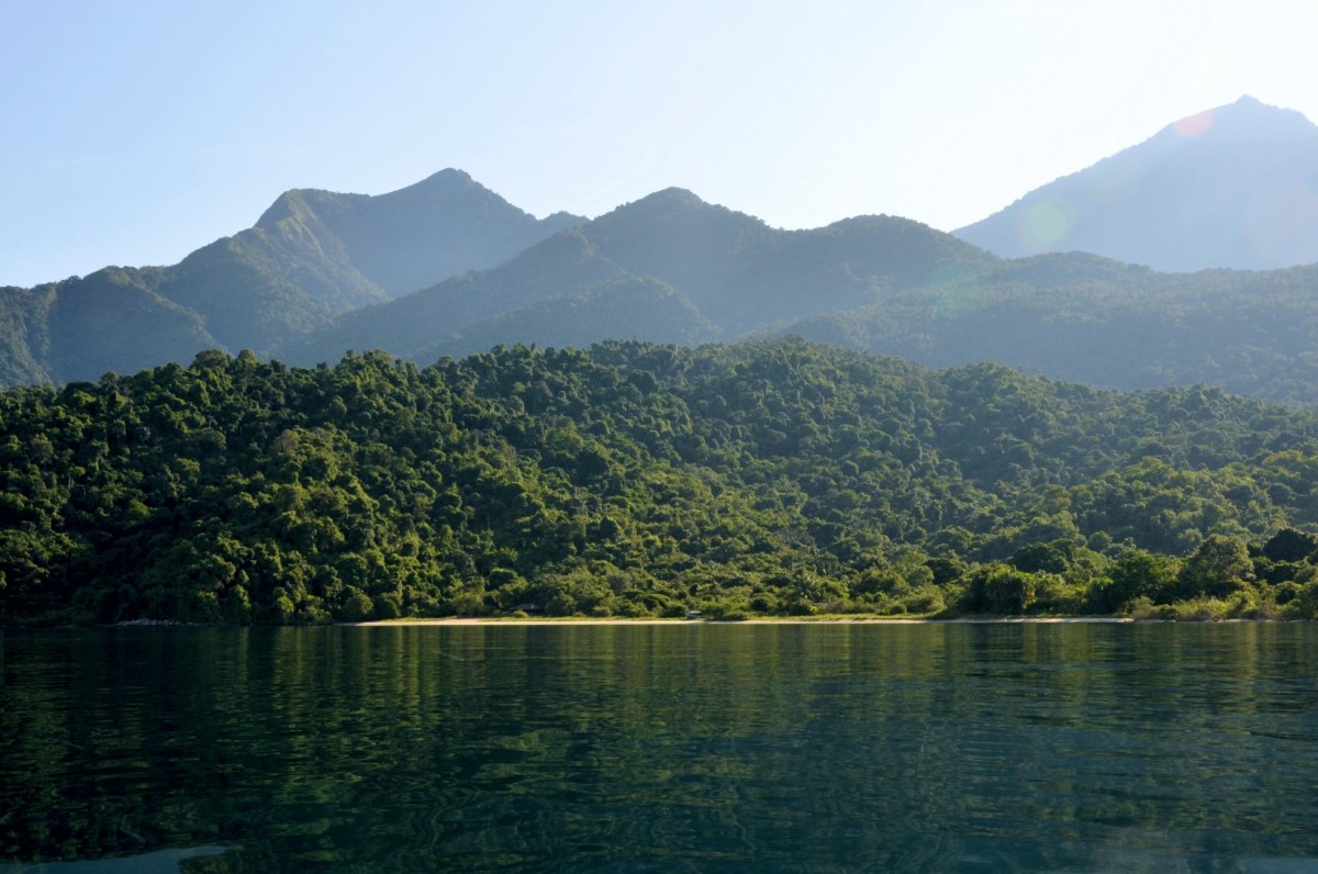
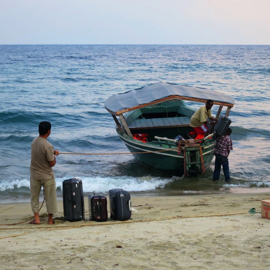
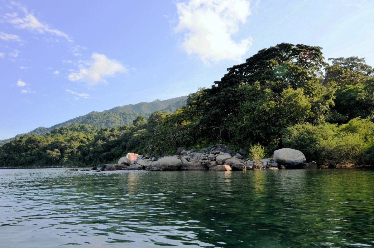
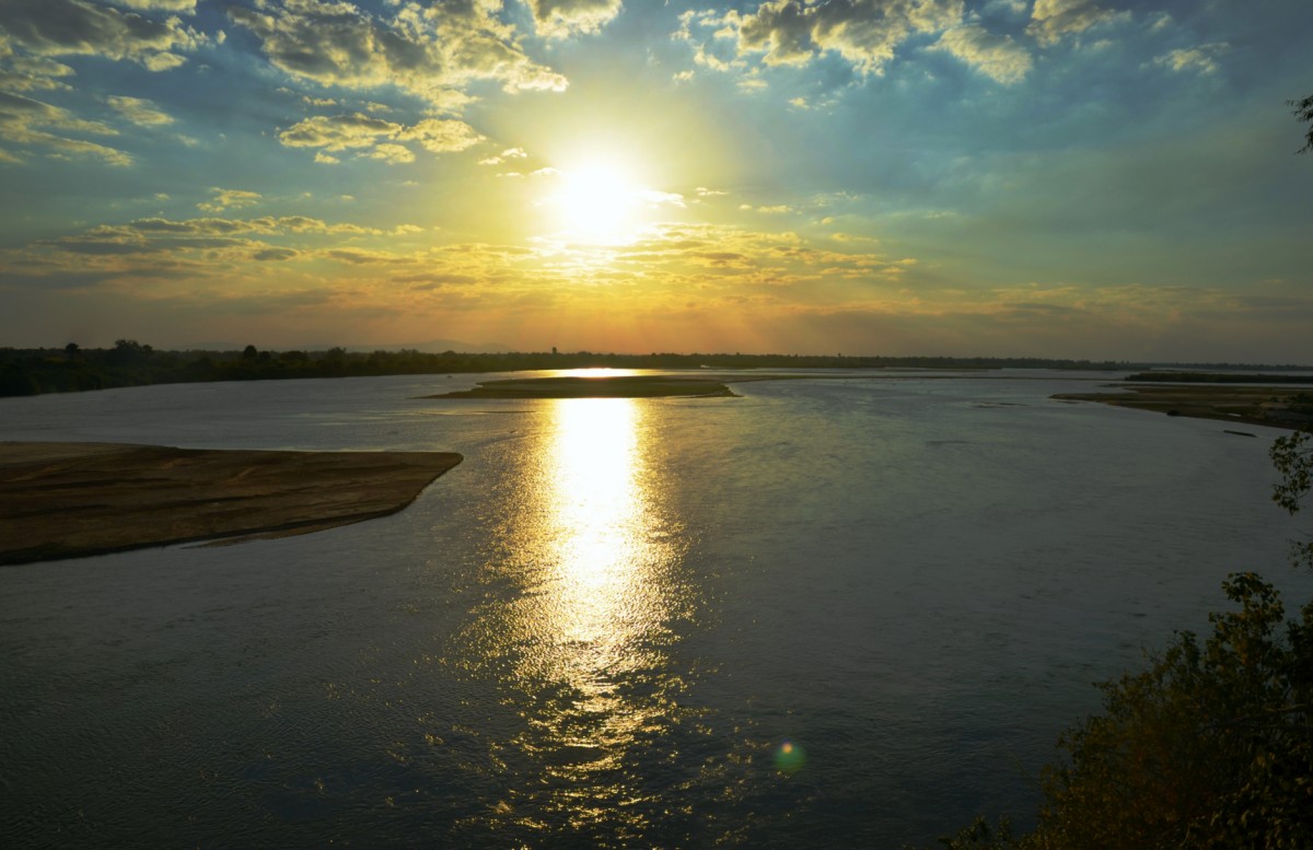
Lake Tanganyika
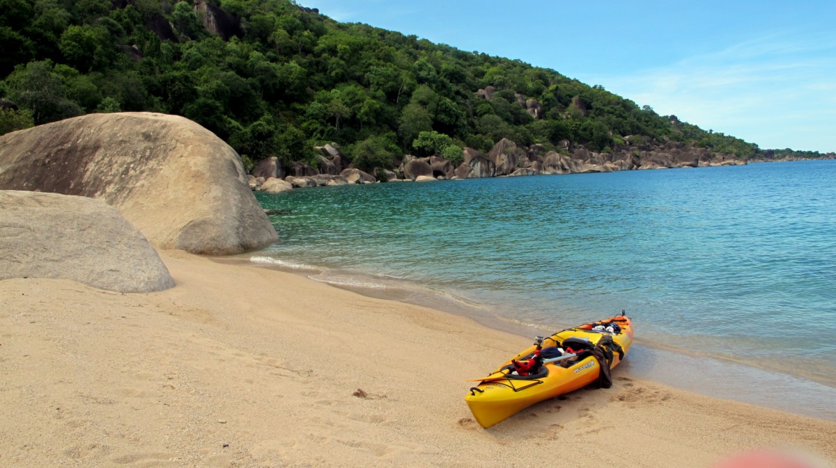
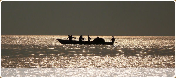
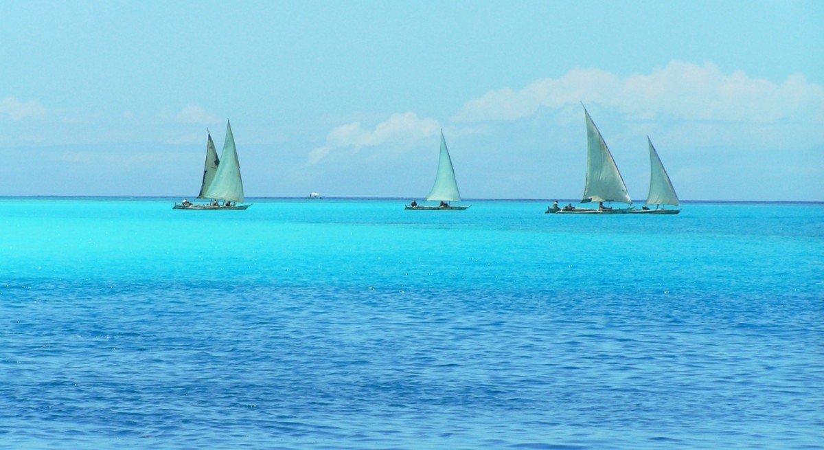
The pearl and lifeblood of western Tanzania is Lake Tanganyika, the longest and second deepest lake in the world. 676 km long, 50 km wide, and about 1'500 m deep – these are monumental dimensions of the species-rich lake. 2,000 species call it home, over 90% of them endemic. Most of them are cichlids, but there are puffer fish, catfish, lungfish, crabs, etc. Many of them are known worldwide as ornamental fish in aquariums. A diving mask is essential when visiting Lake Tanganyika.
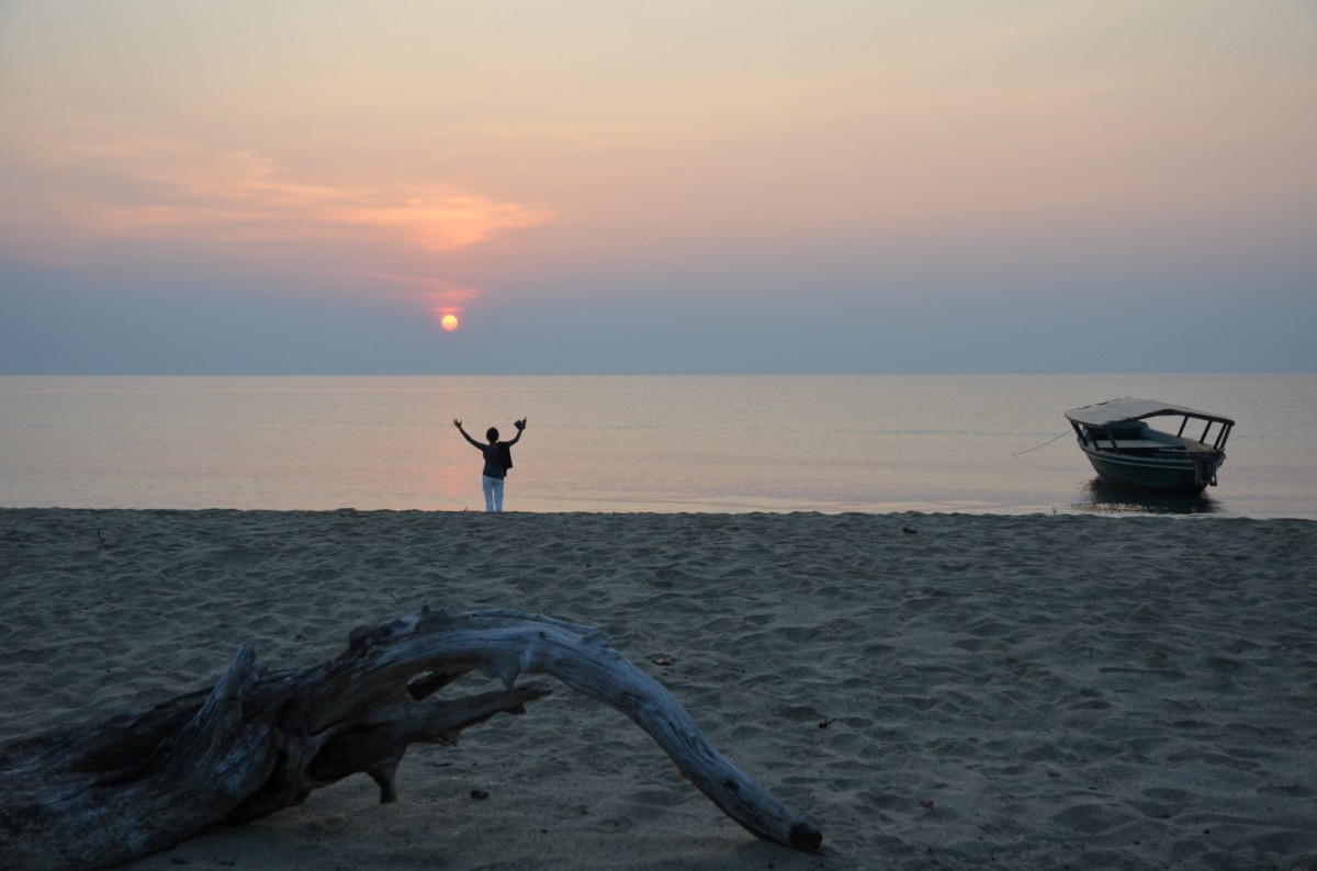
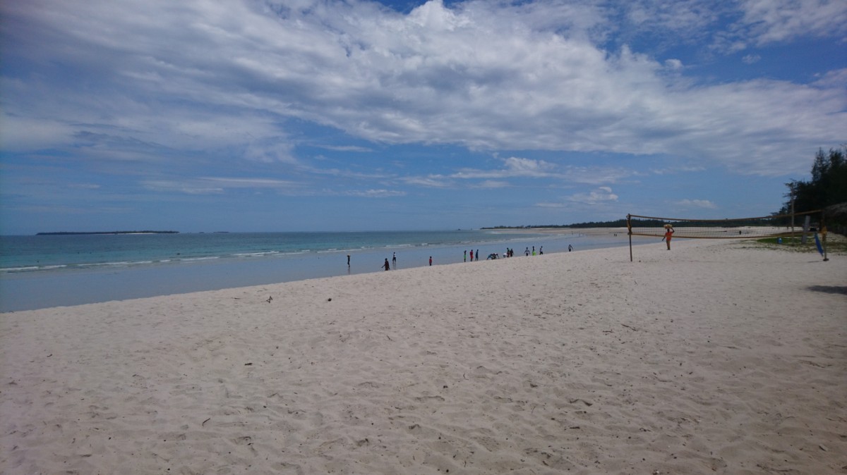
Rainforests, mangroves, and long sandy beaches line the lake, offering opportunities for beach vacations, sunset boating, scuba diving, snorkelling, and canoeing. A stay on Lake Tanganyika could be combined with a visit to the Mahale national park.
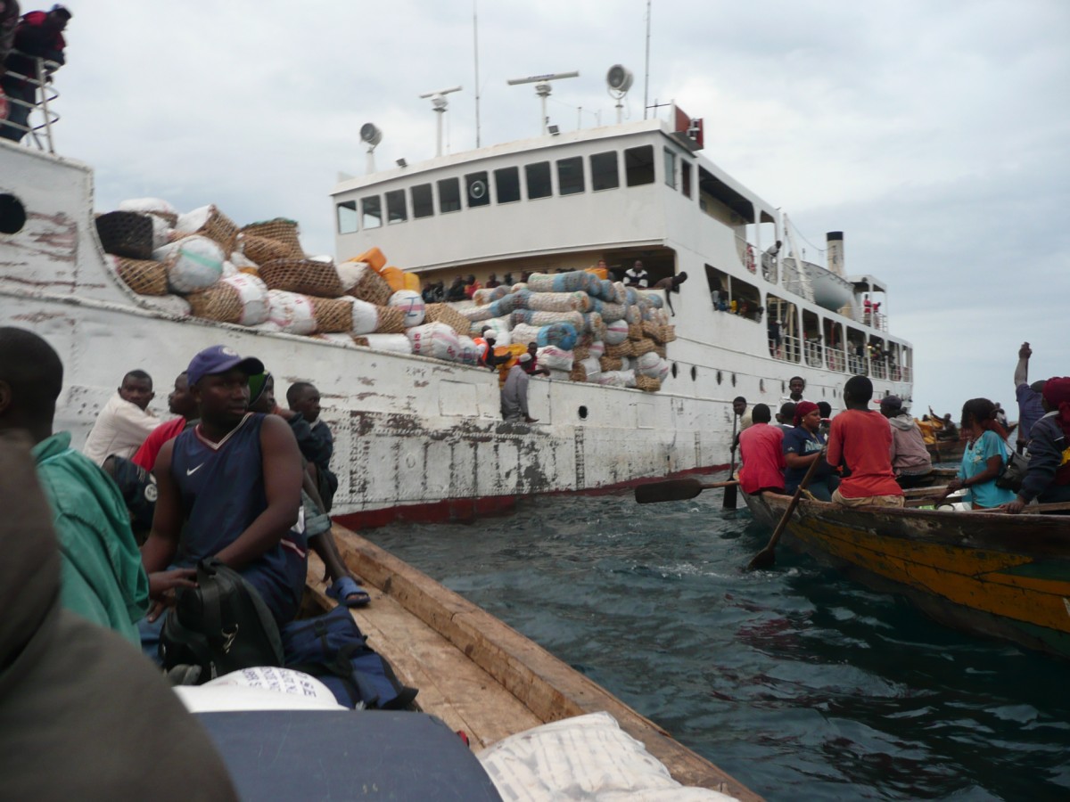
"M.V. Liemba", an old ship that sailed across Lake Tanganyika for the first time in 1915, is one of the lake’s legendary accessories. Built in Germany, it was dedicated to the former governor of German East Africa, the "Earl of idols". When the Belgians invaded Kigoma during the First World War, the Germans did not want to leave the ship to them. So they simply sank it in a ”dark corner” of the lake. The plan was to recover it, once the war was won. The ship spent eight years under water before being brought back to the surface by the English. Since then, she has sailed the lake under the name of Liemba and to this day, serves as the main means of transport for passengers and food.
Images
Arusha National Park
Arusha is a relatively small town in northern Tanzania, but the safari mecca. From there, all safaris start in the nearby and well-known national parks Tarangire, Lake Manyara, Ngorongoro and the Serengeti. Kilimanjaro International Airport is about an hour's drive outside of Arusha on the route to Moshi, starting point for Kilimanjaro-Terkkings.
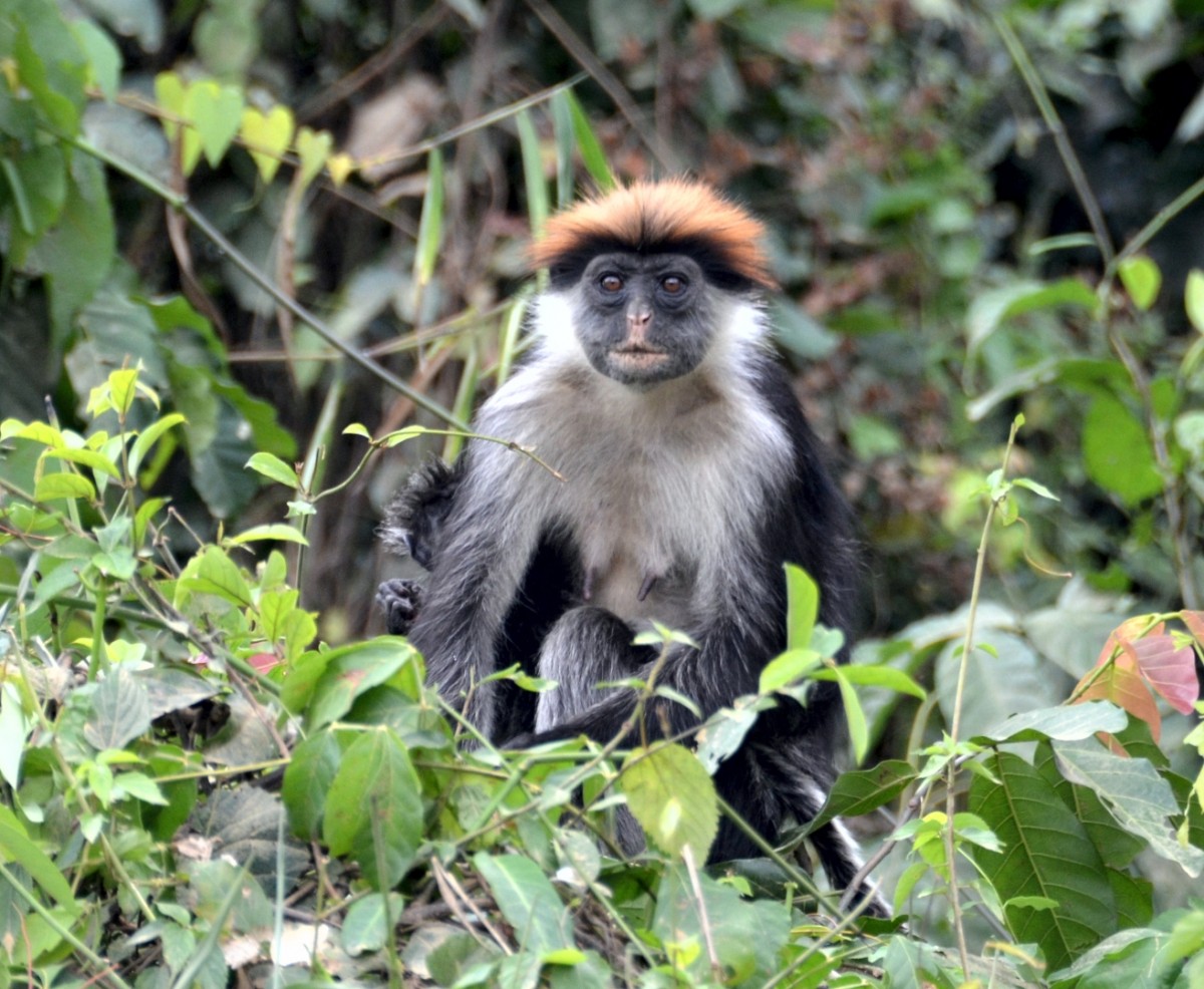
The nearest national park bears the same name as the city, but is relatively unknown as the park does not attract large animals. It stretches between the 4'500 m high Mount Meru, the little brother of the neighboring Mount Kilimanjaro, the Momela Lakes and the Ngurdoto Crater, another relic of once volcanic activity. Lush mountain rain forests that thrive on the flanks of the crater and Mount Merus, grassy areas, marsh, and moorland around the lakes characterize the versatile appearance of the park. The forest provides protection for black-and-white colobus monkeys, mantled guereza, and diademed monkey. The vantage points on the Ngurdoto crater rim offer a view of the crater floor, where animals like buffalo, warthogs, and waterbucks are frolicking. In addition to the usual safari drives in the car, the Arusha National Park is ideal for exploring on foot at the side of a gamekeeper.
The Mount Meru, the little brother of Mount Kilimanjaro was once as high as it was, but lost its peak in a violent eruption some 6,000 years ago. So he stands today with its approximately 4'562 m altitude usually in the shadow of his big neighbor. However, it is worthwhile to climb this scenic mountain, away from the tourist crowds. The tour starts in the Arusha National Park on the side of an armed gamekeeper, which protects you from wild animals until the steep ascent. The path leads through wooded savannah, dense mountain rainforests, heathland and bizarre volcanic rock formations to the summit, which offers wonderful views of the Kilimanjaro and the vast savannah. Mount Meru is often climbed in preparation for Kilimanjaro trekking, but the technical requirements are higher on Mount Meru than on the Kilimanjaro routes.
Images

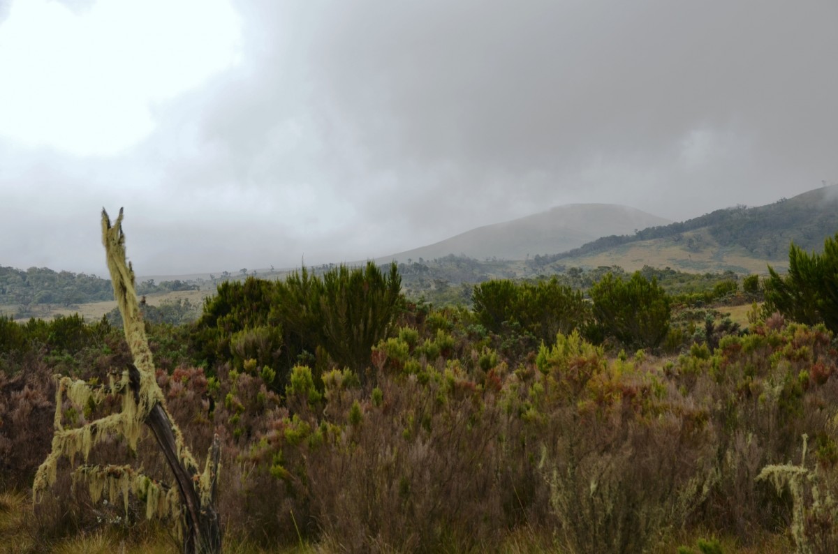
Lake Natron
Lake Natron is located in the Maasai region of the East African Rift Valley system and is surrounded by volcanoes. Ol Doinyo Lengai is the only active volcano in Tanzania, all others are dormant. Volcanic rocks, ash, and high evaporation are responsible for the soda-rich water of the lake, which can reach a pH-value of up to 12. The surface of the only 0.5m-deep lake varies between 1'000 km2 in the rainy season and a few square kilometres towards the end of the dry season. What remains is a crust of white salt crystals. Purple bacteria turn the water surface blood-red. The same bacteria are responsible for the coloration of lesser flamingos, who absorb them with their food. Lake Natron is the most important breeding ground for lesser flamingos in Africa. From July to October, up to 2 million animals are breeding here. They often to build their nest mounds of mud in a place where people have no access. Even for animal enemies, such as hyenas, the breeding area is inaccessible. During the rainy season (March to June), the otherwise desolate stone desert around the lake is transformed into lush pastures that provide food for gnus, zebras, ostriches, and the cattle of the Maasai.
The ascent to Ol Doinyo Lengai is reserved to adventurous, experienced, and responsible hikers. The path leads along gullies dug into the deposited lava and ash deposits. The hard, six-hour ascent is rewarded with a wonderful view. Sulphurous clouds of smoke rise from holes, and you can hear and see the lava seething inside the crater. The most recent eruption of the volcano was in 2010.
The hike to a waterfall, where you can treat yourself to a cooling shower, is easier and shorter. The creek has dug a gorge in the volcanic rocks through which you will be able to access the waterfall.
Further tours are offered to hot springs, the recently discovered footprints that may be more than 120'000 years old, or to one of the surrounding Masai bomas.
Images
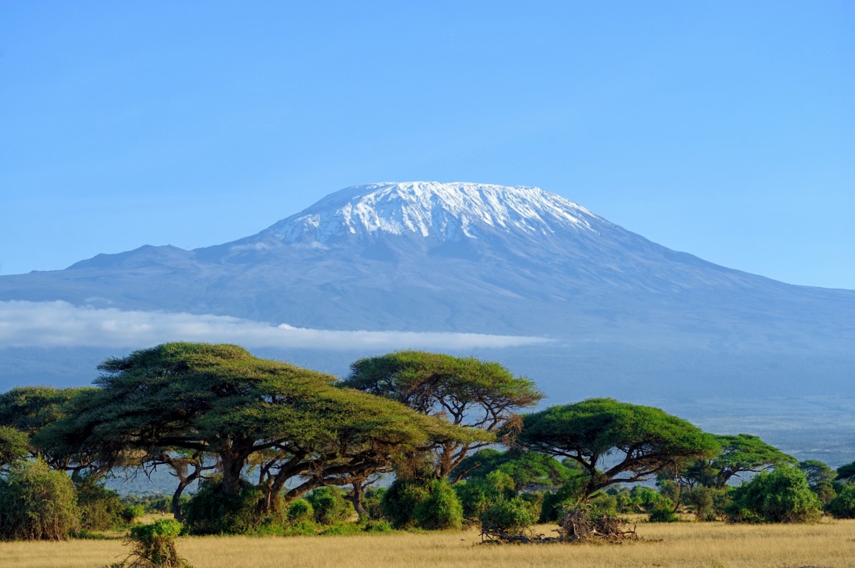
Mount Kilimanjaro
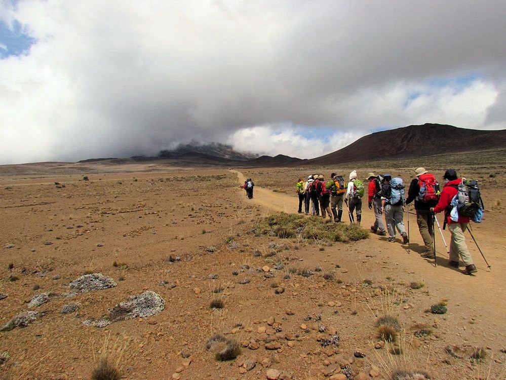
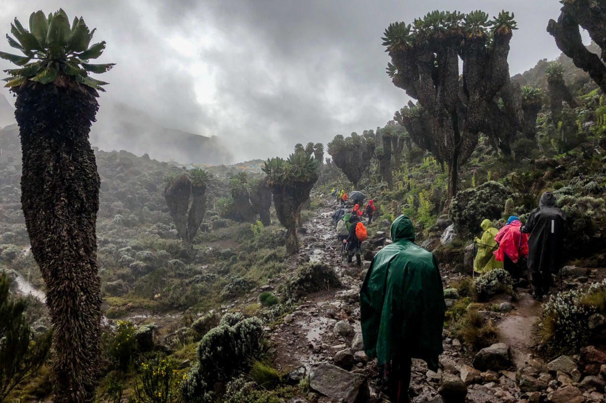
With an altitude of 5,892 m, Kilimanjaro is not only the highest peak in Africa, but also the highest freestanding mountain in the world. Upon the emergence of the East African Rift Valley 1.5 million years ago, a powerful, volcanic mountain began to form. Mount Kilimanjaro was formed from three different cones (Shira, Mawenzi, Kibo) that created a plateau over time. Today, only gases from the last of the three cones, Kibo, are released. The giant dormant volcano was declared a UNESCO World Heritage Site in 1989.
At the foot of the mountain, coffee and tea plantations spread out on the fertile, volcanic soil, giving way to rainforests as altitude increases. The national park surrounding the mountain starts at 2'500m above sea level. Buffaloes, elephants, leopards, antelopes, and primates live here. At about 3'000m above sea level, there are moorlands with metres high plants and meadows, which eventually is followed by high alpine frugality. On the summit, you will have an unparalleled view of the neighbouring mountains and the vast savannahs.
Climbing the mountain is technically not demanding, so that non-climbers can reach the summit. Altitude sickness, however, is a challenge when climbing the Kilimanjaro. You can fight off the phenomenon by drinking sufficient amounts of water and by taking an additional, one-day break. Ascent and descent require a total of about one week, depending on the route you choose. Nights are spent in simple mountain huts or tents.
The hikes at the foot of the mountain through the tea and coffee plantations or through colourful rainforests are shorter but equally charming. The best travel times to climb Kilimanjaro are between rainy seasons, from January to March and August to mid-October. However, you will then hike in the company of many other visitors.
Images

Ngorongoro Crater
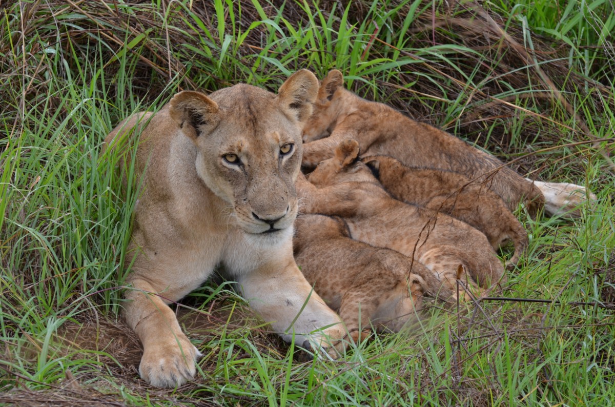
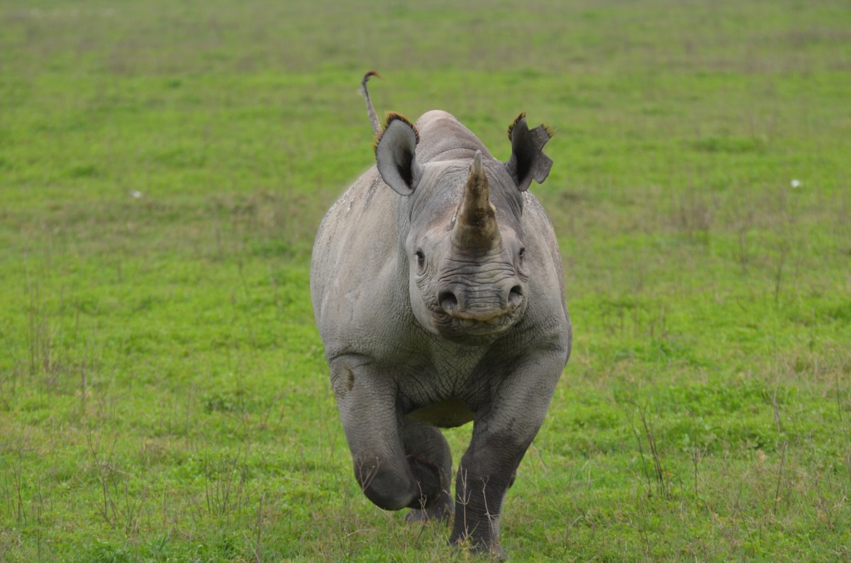
The Ngorongoro Sanctuary, which is connected to Serengeti, is a dream destination for many tourists. The 260-km2 crater represents the core of the area. Today, this area is a paradise for animals – you may get the impression that an African Noah's ark must have been stranded here. Around 25,000 large mammals inhabit the crater which boasts the largest number of predators in Africa. The area was therefore declared a UNESCO World Heritage Site in 1978. The year-round water hole, which is fed by the precipitation on the steep and wooded crater walls, provides a habitat in the otherwise arid region. In Tanzania, it is also the only place where black rhinos, an endangered species, can be spotted. Due to the unique number and diversity of animals, a visit to the Ngorongoro crater is a unique experience. Its disadvantages – high visitor fees and large numbers of tourists – must be considered.
Images
Serengeti National Park
The foundation of the oldest and probably best-known national park in northeast Tanzania dates back to 1951. The continent's second largest reserve is the heart of a vast ecosystem, and a combination of an abundance of species and its unique size. No wonder the park of superlatives attracts well over 100,000 tourists every year.
Sheer endless steppes and acacia bushes characterize the landscape. Water resources are hard to find in the endless plain. In the more unknown western part, the scenery changes, however: Along Grumeti River, endless forests extend in the direction of Lake Victoria.
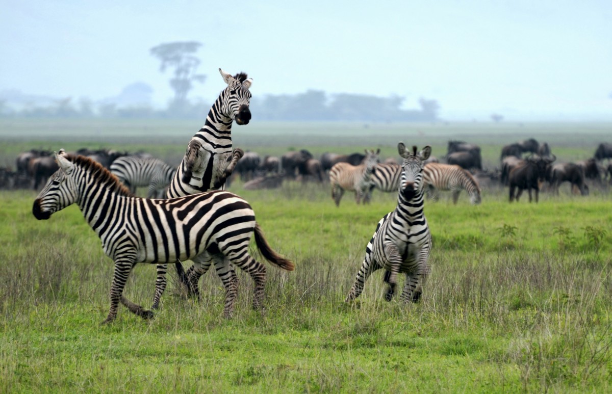
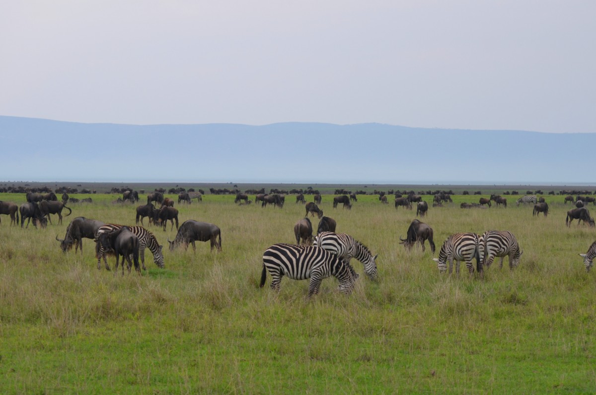
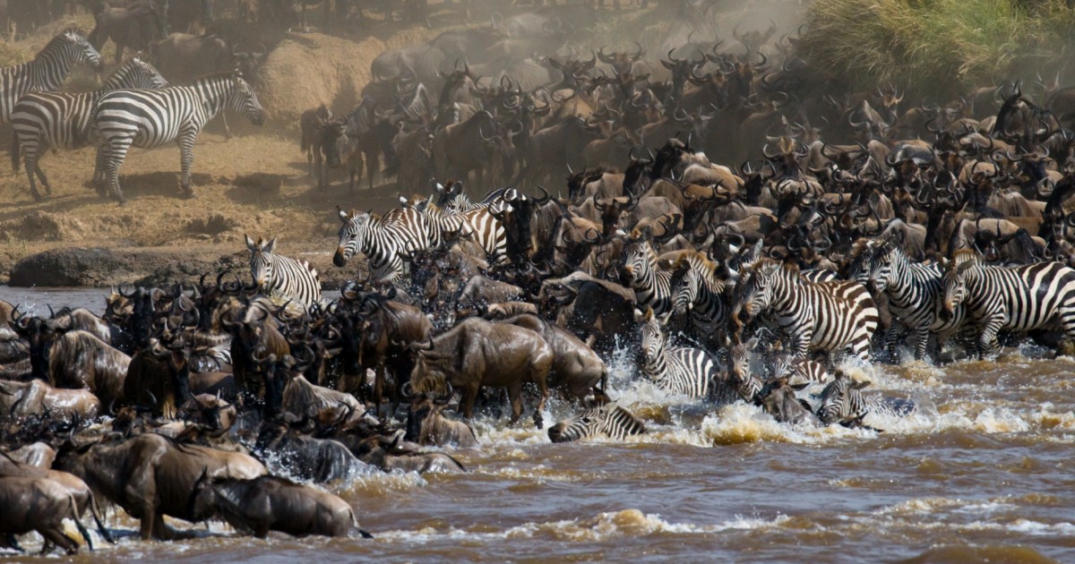
The struggle for survival has spawned one of the most spectacular Serengeti natural phenomena – the Great Migration: millions of gnus, zebras, and other gregarious animals move across the entire Serengeti every year northbound to the Masai Mara region of Kenya in search of water and pastureland and back again, following the rain and lush grass instinctively and persistently. They are always accompanied by cats of prey and hyenas, to which weaker animals fall victim.
The climax of this magnificent spectacle takes place between April and July, when gnus cross the two rivers, Grumeti and Mara, a feast for local crocodiles.
Images
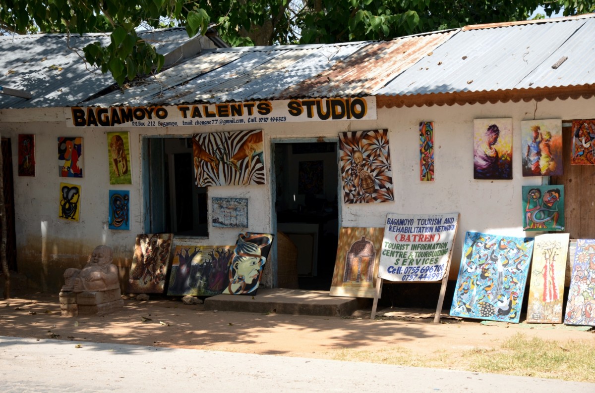
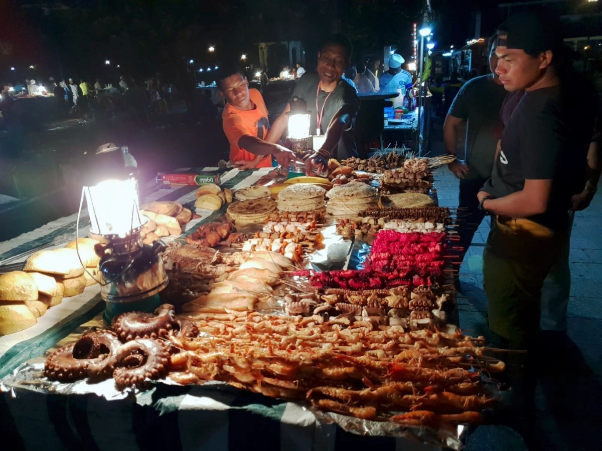
Bagamoyo
The short-lived capital of German East Africa was one of the most important economic, religious and political arenas in East Africa over 100 years ago. The nearby sea route to the spice island Zanzibar helped Bagamoyo with the active slave and ivory trade to a sad notoriety. Bagamoyo means in Swahili "Put down your heart". If the slaves had survived the exhausting trek from the hinterland, their last hope of escape was with the appearance of the sea. So they had to leave their hearts in Africa when climbing the dhows to Zanzibar and Arabia.
As an important hub, Bagamoyo has always been a highly competitive city between the European colonial powers, the Arabs and the Christian Church. Today only a few disintegrating colonial buildings and a well-kept museum of the Christian mission remind of the bygone days in the small town today.
The College of Arts, founded in 1980, is now bringing Bagamoyo back to international fame. It is the only college in Tanzania that trains actors, dancers, musicians, and painters. A guided tour of the school turns out to be a very rewarding experience. On request we can also organize dance and drum classes in the school.
Images
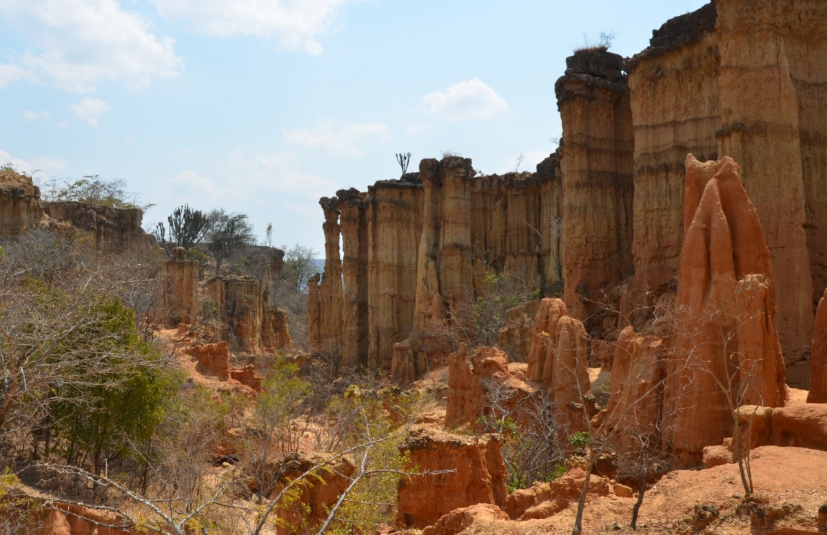
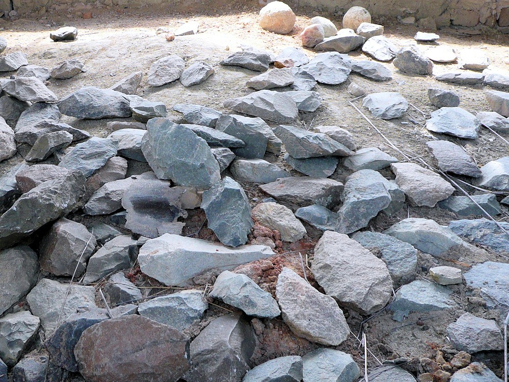
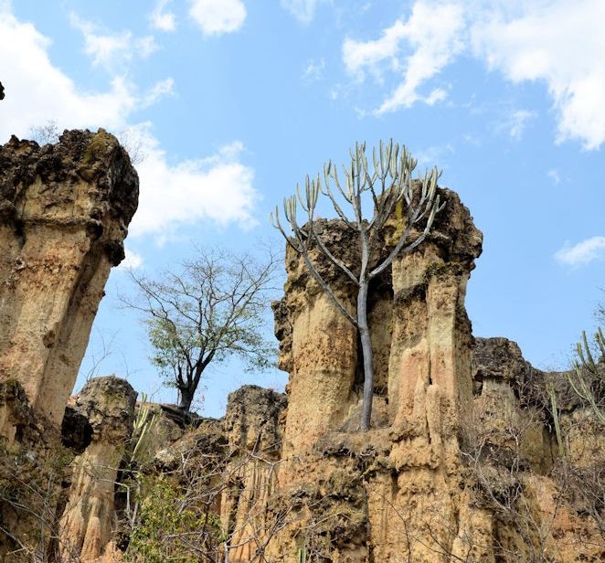
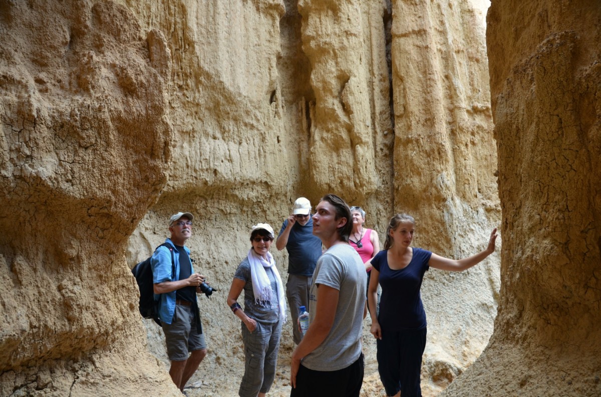
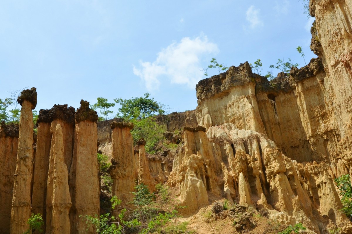
Ismilia
About 30 km southwest of Iringa is a small "Monument Valley" with amazing erosion formations, towers, and needles, which has washed out the water for thousands of years. Down in the valley are many relics of Stone Age tools and weapons that have accumulated over millennia: hand axes, spearheads, slings of all kinds are estimated 30'000 to 60'000 years old. The number of finds suggests that there must have been a significant Stone Age settlement here.
A small museum displays the most important findings; they can be seen scattered everywhere in the valley. Absolutely recommendable is a one-hour walk through the valley with its amazing earth and stone formations. The place can be very well connected with a safari in the Ruaha National Park.
Images
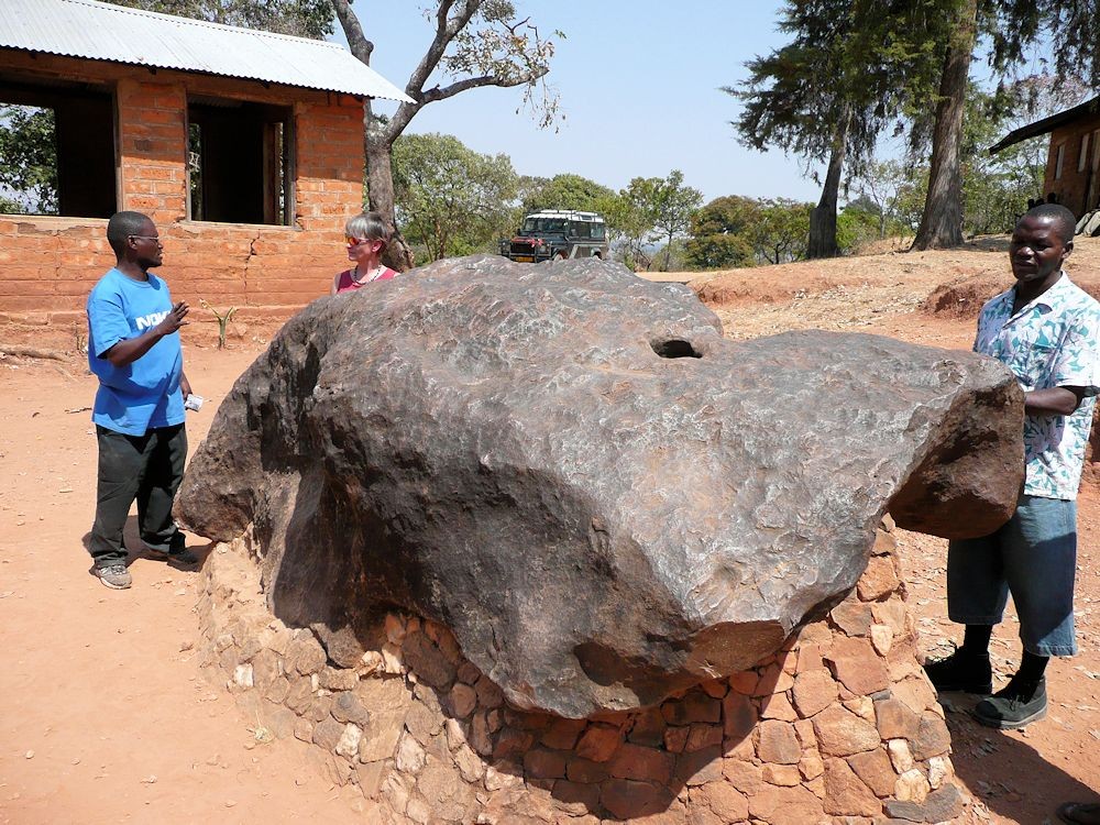
Mbozi Meteorite
The great cold iron-nickel chunk had long been noticed by natives and had its spiritual significance, but the existence of this strange stone was strictly kept secret from foreigners. In 1942, the information seeped through to the colonial rulers, a leak for which the traitor had to pay with his life. The impact date of the meteorite is not known, but it weighs an estimated 13 tons and is one of the largest known meteorites on earth.
Images
Ngozi Crater
This picturesque crater lake is located about half an hour outside the city of Mbeya on the way to Lake Malawi. The Ngozi is the 2620 meter high summit of a mountain range. The legendary crater lake is 2.5 kilometres long and 1.6 kilometres wide, making it the second largest crater lake in Africa. In the water of the dark emerald green colour live fish. To see the crater lake, climb for about 1.5 hours up the steep, wooded slope to the crater rim, where you will be rewarded with a breathtaking view of the lake and the wooded shores of the crater.
With a bit of luck you will encounter black-and-white colobuses and numerous species of birds, for example the trumpeter hornbill. This area is also known for the endemic three-horned chameleon.
Images
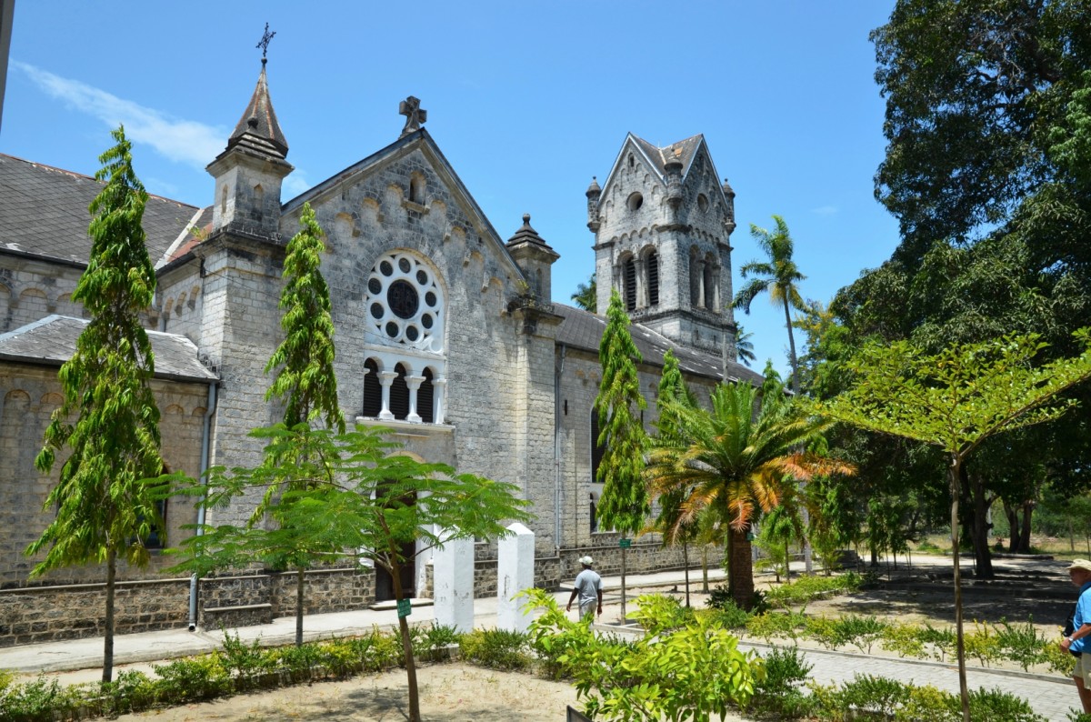
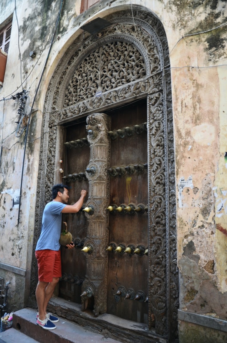
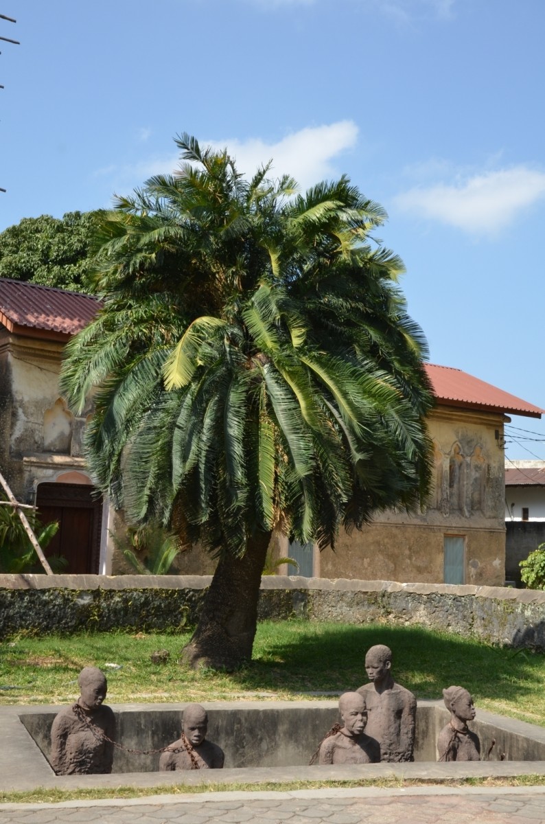
Stone Town
The town centre of Stone Town is a compact labyrinth of oriental buildings with often morbid facades, ornate doors and cobblestone paths. The mixture of African, Arabic and Indian influences earned Stone Town recognition as a UNESCO World Heritage Site. And indeed, the authentic flair has been preserved despite the many tourists to this day.
However, many historic buildings are in poor condition and unfortunately can only be partially visited. A visit to the former slave market is a moving experience.
It is worthwhile to get to know the origin of cardamom, cinnamon, nutmeg, cloves, vanilla or pepper from Stone Town on a spice tour.
Images
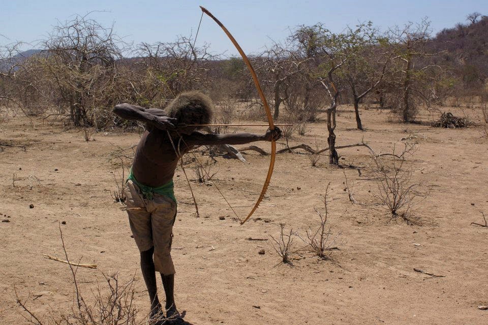
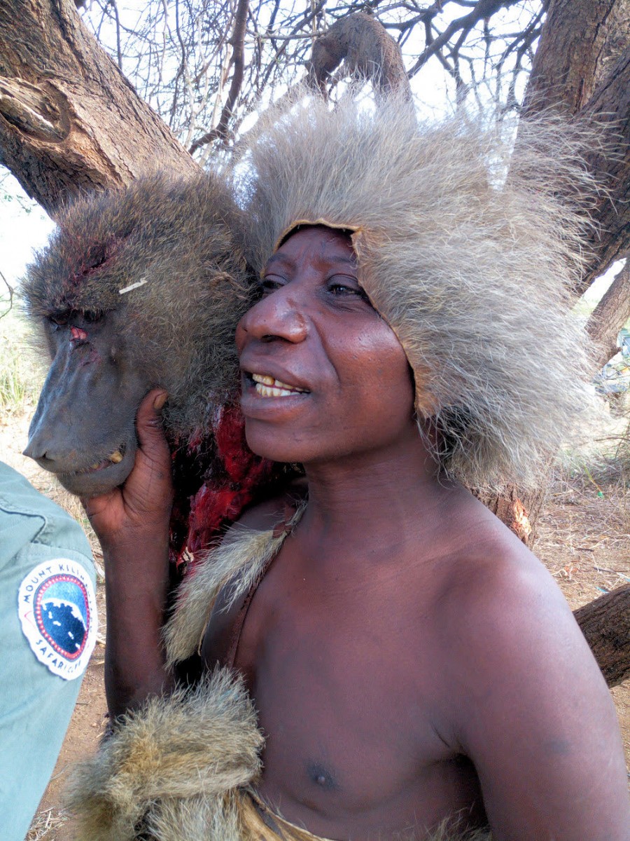
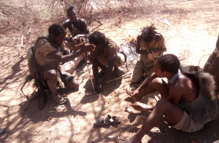
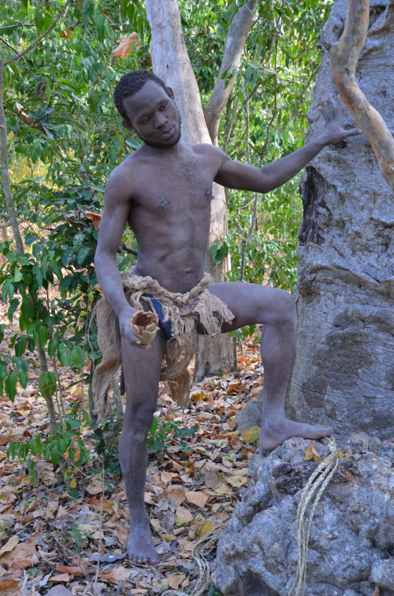
The Hadza
The Hadza, or Hadzabe (plural), are an ethnic indigenous tribe in north Tanzania, living around Lake Eyasi and in the neighboring Serengeti Plateau. There are approx. 1000 Hadza people in Tanzania, however only 400 Hadza still survive exclusively based on the traditional means of hunting and gathering. Archaeological evidence suggests that the area has been continuously occupied by hunter gatherers much like the Hadza since at least the beginning of the Later Stone Age, 50,000 years ago.
As descendants of Tanzania's aboriginal they have most probably occupied their current territory for thousands of years, with relatively little modification to their basic way of life until the past hundred years. The Hadza have come into increasing contact with farming and herding people entering Hadzaland and its vicinity; the interactions were often hostile and caused population decline in the late 19th century. There have been many attempts by successive colonial administrations, the independent Tanzanian government, and foreign missionaries to settle the Hadza, by introducing farming and Christianity. These efforts have largely failed, and many Hadza still pursue virtually the same way of life as their ancestors. In recent years, they have been under pressure from neighbouring groups encroaching on their land, and also have been affected by tourism and safari hunting. Generally, the Hadza willingly settle and take advantage of provided food, but leave and return. Some Hadza families welcome tourists and like to show how they live and hunt.
Link to Wikipedia article about the Hadza.
Images